Anchorage
Mexico - Pacific
Isla la Peña
Depth
20.0 ft
6.1 m
Bottom Composition
S - Sand
Aids to Navigation
Depth Contours
Land
Shore Access
Beach
Notes

Isla Coral is a small island in Bahia de Jaltemba located 1NM from the beach at the southern end of the bay. This is a roadstead anchorage with a little shelter from a northwest wind but little else, really only useful in calm conditions.

Approaches

No info.

Anchorage

Anchor on the east side of the island in 6.1m on sand. Dinghy ashore to the small beach on the island which is usually lined with umbrellas. Take care if landing in the swell.

Facilities

None. Kayaks are available for rent on the island.

Dangers
Offshore Rock
Wind Exposure
N NE E SE S SW W
Swell Exposure
N NE E SE S SW W
marina
Anchorage
Mexico - Pacific
Bahia Matanchen
Depth
15.0 ft
4.5 m
Bottom Composition
S - Sand
Aids to Navigation
Depth Contours
Land
Shore Access
Beach
Notes

The best anchorage for visiting San Blas is in Bahia Matanchen, a large bay a few kilometres east of the town. The bay is renowned for its sand flies, or jejenes as they are called locally and it is recommended to anchor at least a mile from the shore to avoid a boat invasion. The bay is well sheltered from north and east and Punta Las Islitas provides some protection from the west although northerly swell is known to wrap around into the bay. This is not a good anchorage in the summer unless it is a calm day.

Approaches

The C-Map charts on OpenCPN are mis-positioned here by up to 1.75NM, you may appear to be anchored  several hundred metres onshore.

Anchorage

Anchor at least a mile offshore and if possible tuck in behind Punta Las Islitas to get out of the swell. Anchor in 4.5m on sand with good holding but make sure your anchor is well set as thermal breezes from the east blow through the anchorage in the afternoon and can reach 20kt.

Land the dinghy in the northwest corner of the beach in front of the palapa restaurants. There is no where to tie up so set the anchor and ask one of the waiters to keep an eye on it for you, dinghy theft is a problem here.

Facilities

The staff in the palapas where you land your dinghy are helpful with arranging a taxi into San Blas. There are several small grocery stores around the roundabout behind the beach as well as numerous tour operators offering croc-spotting jungle tours. Good seafood can be found at most of the palapas. The sand flies are less bothersome between mid morning and mid afternoon.

Dangers
Sandflies
Mosquitos
Wind Exposure
SE S SW
Swell Exposure
SE S SW
Amenities
Restaurant
Adventure Tours
Grocery Store
Date & Time Visited
2013-11-01T07:24:00
editor
Anchorage
Mexico - Pacific
Depth
33.0 ft
10.0 m
Bottom Composition
S - Sand
Aids to Navigation
Depth Contours
Land
Shore Access
Beach
Notes

The seaside town of Rincon de Guayabitos lies in Bahia de Jaltemba at the southern end of a beautiful 4km long strand of white sand known as Playa Hermosa. The bay behind Punta Raza is sheltered from weather from the south and east however southerly swell wraps around the point making this a rolly anchorage in the summer except on a calm day. In the winter months anchor behind Isla Coral for slightly better shelter from the northerlies.

The beach is lined with houses, resorts and restaurants and tour boats and jet skis buzz around the bay disturbing the peace.

Approaches

No info.

Anchorage

Anchor in front of Playa los Ayala in 10m on sand with good holding. The beach behind Punta la Puntilla is better for landing a dinghy.

Facilities

Along the beach there are numerous restaurants to choose from. An ATM can be found a couple of blocks back from the beach before the Guayabitos sign. There is a cinema on Avenida Sol Nuevo close by. There are a couple of service stations on the main road close to the "kink" in Avenida Sol Nuevo, but be very careful loading full jerry cans into the dinghy in the surf.

Wind Exposure
N NE NW
Swell Exposure
N NE SW W NW
Amenities
ATM
Restaurants
Movie Theatre
Date & Time Visited
2009-01-05T11:35:00
editor
Anchorage
Mexico - Pacific
Depth
8.0 ft
2.0 m
Bottom Composition
M - Mud
Aids to Navigation
Depth Contours
Land
Local Marks
Channel Marks
Shore Access
Marina
River
Notes

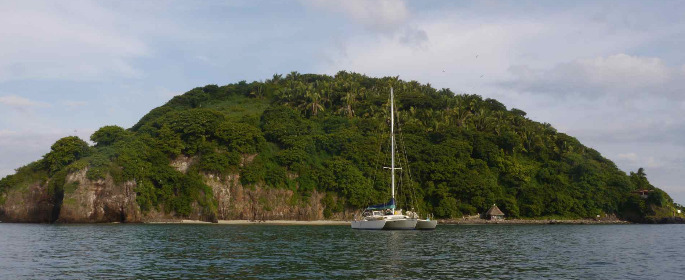
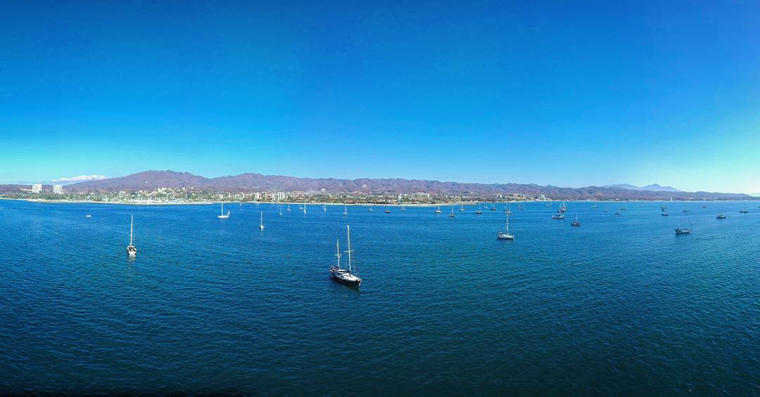
San Blas is located on the Nyarit coast about 65NM from Bahia Banderas. In the mid-1700´s this small sleepy town was the base from which the Spanish navy explored and colonized the Pacific coast of America. Later the town rose to prominence again as a Pacific port for trade with the Philippines. These days tourists come to San Blas to explore the historic town and beautiful beaches.

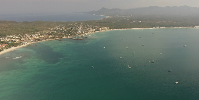
The anchorage opposite the marina entrance is very well protected from all but a southeasterly wind. It has 2-4m of water in the channel on the west side of the shoal area which extends across the marina entrance. The mosquitos and sand flies can be voracious.
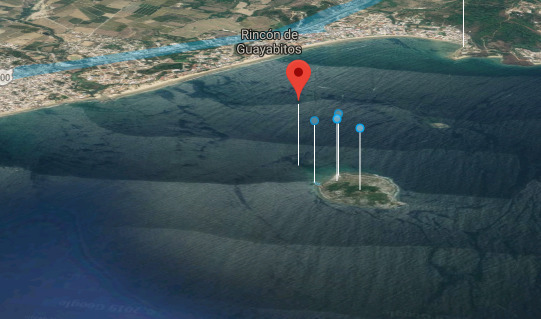
Approaches

Entrance into the river channel is hazardous in all but the calmest swell conditions. Crossing the sand bar needs to be well planned and local knowledge is advised before attempting the entrance. The marina can send out a panga to guide you in.

The river channel is marked with buoys, favour the starboard side of the channel as the port side shoals quickly. Watch out for the very shallow area west of the marina entrance.
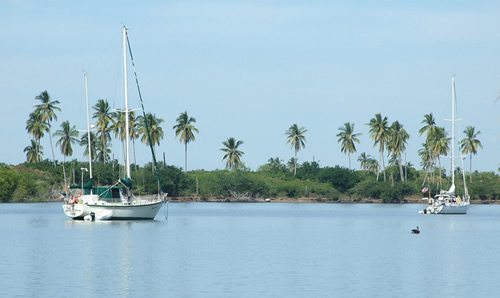
Anchorage

Anchor in 2m on the west side of the shoal in soft mud. Dinghy into the dock at the marina. The anchorage can be noisy with jungle tour pangas swerving between boats.

Facilities

As well as a fine church, elegant colonial buildings and the old customs house San Blas boasts a couple of supermarkets, a suite of grocery stores and a great municipal market for good provisioning options. There is some wifi coverage in the anchorage.

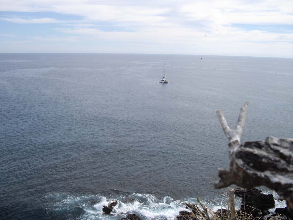
A taxi is the easiest way to reach the Contaduria as it’s difficult to find. Once an impressive hilltop fort built to protect the town and guard the colonial riches, the original structure was destroyed in a hurricane but the view over the town and out across the Pacific Ocean is fabulous.

Dangers
Sandflies
Mosquitos
Shoaling
Swell
Wind Exposure
SE
Amenities
Supermarket
Grocery Store
Bank
Market
Restaurants
Hospital
Date & Time Visited
2014-03-20T07:37:00
editor
Anchorage
Mexico - Pacific
La Cruz Anchorage
Nayarit
Depth
38.0 ft
11.5 m
Bottom Composition
S - Sand
Aids to Navigation
Depth Contours
Land
Shore Access
Beach
Boat Ramp
Dinghy Dock
Notes

Located in the northern corner of the bay, La Cruz de Huanacaxtle is the most popular anchorage in Bahia Banderas. The large bay has a marina on the western side and space for scores of boats to swing on moorings or anchor. It is open from southeast to southwest so can be quite windy and rolly in the summer months.

The village of La Cruz de Huanacaxtle is very picturesque with cobbled streets and brightly painted houses and a vibrant music scene.

Approaches

No info.

Anchorage

Find a spot amongst the other boats and drop anchor in 10-12m on a sandy bottom. Avoid anchoring too close to the entrance channel into the marina as it has plenty of dinghy traffic. Take the dinghy into the dinghy dock of the marina where a small daily fee is charged. Alternatively land the dinghy on the beach to the east of the harbour wall for a shorter walk in to the village.

Facilities

La Cruz has numerous small grocery stores, a bakery and a butcher and a very good fish market. The bus to Puerto Vallarta stops on the main road at the end of Avenida de la Langosta. There are also a couple of chandleries opposite the bus stop. The village has a lively nightlife with several good restaurants and live music flowing from at least one or two of the bars around town. It’s a great place to hang out.

There is no bank in the village and, at the time of writing, the ATM in the village was not secure. Cruisers avoided using it and took the bus to the bank in Bucerias go withdraw money.

Dangers
Swell
Wind Exposure
E SE S SW
Swell Exposure
E SE S SW W
Amenities
Fish Market
Marina
Restaurant
Bar
Concert Stage
Chandlery
Fueldock
Airport
Date & Time Visited
2009-01-01T12:48:00
2019-03-19T11:11:11
editor
Anchorage
Mexico - Pacific
Approach
◬ 20° 46.4166 N 105° 37.1475 W
◬ 20° 44.5289 N 105° 32.5333 W
◬ 20° 44.6059 N 105° 30.8750 W
◬ 20° 45.7328 N 105° 30.8647 W
Depth
25.0 ft
7.5 m
Bottom Composition
S - Sand
Aids to Navigation
Depth Contours
Land
Shore Access
Beach
Notes

The name Punta de Mita comes from the Aztec word “mictlan” reflecting the original inhabitants of the area around 2000 BC. The peninsula has been invaded by the Spanish, settled by Mexicans and recently redeveloped into one of the most exclusive resort communities in Mexico. The entire peninsula west of the town is privately owned and carpeted with resorts and golf courses.

The peninsula protects the bay from most swell except from the southern sector. The large bay is open from southeast to southwest but is sheltered from wind and swell from all other directions. It is a popular destination for day trippers and has a lot of panga and tour boat traffic.

Approaches

No info.

Anchorage

7.5m sand with good holding. Dinghy ashore to the beach being careful landing if waves are breaking. Local boats pull up just inside the western breakwater, avoid the west end of the beach which is private and casual visitors are not welcomed.

Facilities

The beach at Punta de Mita is lined with restaurants and tour operators. The modern town behind the beach has several ATMs and grocery stores, a pharmacy, a good supermarket and a hospital.

Wind Exposure
SE S SW
Swell Exposure
SE S SW
Amenities
Supermarket
Restaurants
Tour boat operations
Golfcourse
Pharmacy
Hospital
Bank
Date & Time Visited
2009-01-28T13:21:00
editor
Anchorage
Mexico - Pacific
Depth
38.0 ft
11.5 m
Bottom Composition
S - Sand
R - Rocky
Aids to Navigation
Depth Contours
Land
Notes

Tres Marietas islands are the visible part of a long finger of rocks and reefs that extends for 10NM southwest of Punta Mita. The islands are part of a UNESCO Biosphere Reserve and the colourful coral and abundant reef fish attract divers and snorkelers for day trips to the islands.

The main anchorage is on the east side of Isla Larga which is the westernmost of the two biggest islands, marked by a white flashing light. The islands provide no shelter from the wind and swell and this is a poor overnight anchorage. On a calm day the anchorage can get crowded and noisy with tour boats and day trippers.

Approaches

No info.

Anchorage

The coastline of the islands is dotted with uncharted rocks and should be approached with care and a lookout on the bow.  Find a spot of sand amongst the rocks and 10-15m on rocky sand with poor holding. There are no beaches on the island.

Facilities

None.

Dangers
Uncharted Rocks
Reef
Wind Exposure
N NE E SE S SW W NW
Swell Exposure
N NE E SE S SW W NW
Date & Time Visited
2009-01-15T14:52:00
editor
Anchorage
Mexico - Pacific
Isla Isabel
Approach
◬ 21° 50.5236 N 105° 52.9176 W
◬ 21° 50.3779 N 105° 52.8906 W
◬ 21° 50.1209 N 105° 52.9653 W
◬ 21° 49.9823 N 105° 53.3528 W
◬ 21° 49.9835 N 105° 53.3541 W
Depth
43.0 ft
13.0 m
Bottom Composition
S - Sand
R - Rocky
Aids to Navigation
Depth Contours
Land
Shore Access
Beach
Notes

Isla Isabella is an isolated volcanic island located at the mouth of the Sea of Cortez and 42NM from San Blas. Known as the “Galapagos of Mexico” the island is home to thousands of birds including frigate birds, boobies and tropic birds and is protected as a World Heritage Site.

Reefs and isolated rocks surround much of the island but anchorage can be taken in the southern bay or in a roadstead anchorage on the eastern coast. The hills surrounding the southern bay give some protection from southwest to northeast but the northern swell wraps around Punta Bobos. The anchorage is not recommended in the summer months except in calm conditions.

Approaches

Approaching the southern bay keep a sharp lookout for fishing nets and buoys, the fishing around the island is very good.

Anchorage

Anchor in the eastern lobe of the bay in 8-10m tucked in behind Punta Bobos for some protection from the swell. Look out for rocks and choose a sandy patch to drop the pick, use a trip line on the anchor in case of snagging behind a rock. Take the dinghy into any of the beaches in the bay depending upon the swell.

Facilities

None. There is a fishing settlement in the central lobe of the bay with pangas puled up on the beach. An abandoned research station lies to the west of the shacks and the short stumpy trees around the building are thick with nesting frigate birds. The females nurture their chicks while the males puff up the big red bladder on their chests and make a sort of hollow rattle noise to attract the girls.

From there the path leads up a steep hill towards the light to a colony of boobies. They are completely unafraid of humans and if you pass to close to the nests the males whistle or the females croak to warn you off. Several species of iguana also live on the island.

Dangers
Swell
Wind Exposure
E SE S SW
Swell Exposure
E SE S SW W
Amenities
Hiking Trail
Date & Time Visited
2008-12-05T12:15:00
editor