Anchorage
Dominican Republic
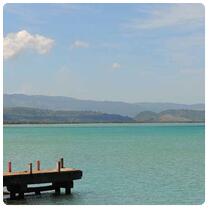
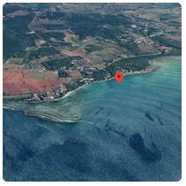
Playa el Castillo
Approach
◬ 19° 53.7521 N 71° 5.2943 W
◬ 19° 54.8342 N 71° 5.8482 W
Depth
11.0 ft
3.3 m
Bottom Composition
S - Sand
Aids to Navigation
Depth Contours
Land
Shore Access
Beach
Dock
Notes

In 1493, Christopher Columbus erected the first intentional European colony in the New World. It was built as a base from which the presence and dominion of the Spanish in the Indies would be established, and it was the American home of Columbus.

The deposit is located on the east bank of the Bajabonico River where it empties into the Bay of La Isabela, about 28 miles west of the modern city of Puerto Plata, on the north coast of the Dominican Republic. Columbus brought 17 ships loaded with 1,500 men, along with pigs, horses, cows, and other livestock, seeds, and plants to plant, as well as the tools and equipment necessary to start the colony. The settlers included artisans, builders, Franciscan friars, and people from other occupations and social classes.

The town was surrounded by a wall, with a fortified warehouse on one end and the Casa de Colón on the other. It had a plaza overlooking the water, buildings several stories high, and some 200 palm houses that served as housing for the city's inhabitants.

Archaeological evidence shows that there was a second town near the walled town that served as a center for pottery, industry, agriculture, and farms. La Isabela was only populated for 5 years, since deaths from diseases, hard work, indigenous hostilities, famine and rebellions caused its abandonment when the town of Santo Domingo was established in 1496-97.

Archaeologists from the Florida Museum of Natural History collaborated with the National Parks Directorate of the Dominican Republic, and with the Francisco de Miranda National and Experimental University of Venezuela to excavate and study La Isabela, from 1989 to 1999. The results of these investigations are You can see in the Museum of the Park of La Isabela.

Dangers
Reef
Wind Exposure
N W NW
Swell Exposure
N NE W NW
Amenities
Historic Site
Museum
admin
Anchorage
Dominican Republic
Santa Barabara de Samana
La Aguada
Approach
◬ 19° 11.4235 N 69° 18.8610 W
Depth
20.0 ft
6.1 m
Bottom Composition
S - Sand
Aids to Navigation
Depth Contours
Land
Shore Access
Beach
Causeway
Dangers
Causeway
Bridge
Wind Exposure
SE S
Swell Exposure
SE S
Amenities
Museum
Marine Services
Date & Time Visited
2020-01-29T11:11:01
AY CARAMBA
Anchorage
Australia - New South Wales
Cocora Point
Twofold Bay - N
Approach
◬ 37° 4.8602 S 149° 55.3674 E
Depth
23.0 ft
7.0 m
Bottom Composition
S - Sand
Aids to Navigation
Depth Contours
Land
Lights
Shore Access
Beach
Dock
Wind Exposure
SE S SW
Swell Exposure
SE S SW
Amenities
Museum
Town
Park
Maritime Museum
Anonymous