Anchorage
Panama
Isla Platanai
Approach
◬ 8° 21.3611 N 78° 57.6390 W
Depth
13.0 ft
3.7 m
Bottom Composition
S - Sand
Aids to Navigation
Depth Contours
Land
Shore Access
Beach
Notes

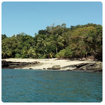
Great anchorage in mod to light N - NW . Sand bottom. 13' at 0 tide. 

Dangers
Rocks
Wind Exposure
E SE S SW W
Swell Exposure
E SE S SW
Date & Time Visited
2017-09-12T12:00:00
admin
Anchorage
Panama
Approach
◬ 8° 20.2622 N 78° 49.6791 W
Depth
30.0 ft
9.0 m
Bottom Composition
S - Sand
Aids to Navigation
Depth Contours
Land
Shore Access
Beach
Notes

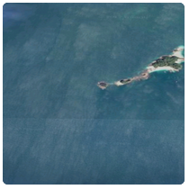
sand bottom 30' water. Beautiful anch and lovely beach 

Dangers
Rocks
Wind Exposure
E SE S
Swell Exposure
E SE S
Date & Time Visited
2017-09-12T12:00:00
admin
Anchorage
Panama
Isla del Rey - S
Approach
◬ 8° 17.0717 N 78° 53.8370 W
Depth
12.0 ft
3.5 m
Bottom Composition
S - Sand
Aids to Navigation
Depth Contours
Land
Shore Access
Beach
Notes

12' at zero water sand bottom Calmer
than Rio Cacique anch. If Victor should come by and offer to

get some fruit beware. Rip off bad fruit and very expesnive 

Wind Exposure
SE S
Swell Exposure
SE S
Date & Time Visited
2017-09-12T12:00:00
admin
Anchorage
Panama
Approach
◬ 8° 35.3612 N 79° 0.8081 W
Depth
17.0 ft
5.0 m
Bottom Composition
S - Sand
Aids to Navigation
Land
Lights
Shore Access
Beach
Notes

17' low tide. Some swell

Dangers
Swell
Wind Exposure
NE E SE SW
Swell Exposure
E SE SW
Date & Time Visited
1999-12-12T12:12:11
Anonymous
Anchorage
Panama
Isla Bayoneta - South Anchorage
Approach
◬ 8° 28.8845 N 79° 3.4184 W
◬ 8° 27.6773 N 79° 3.2993 W
Depth
7.3 ft
2.6 m
Bottom Composition
S - Sand
Aids to Navigation
Depth Contours
Land
Shore Access
Beach
Notes

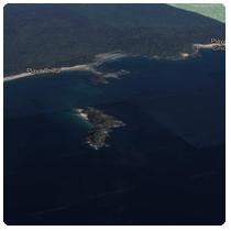
Anchored here on a 0.0 low tide.
7.3' measured with a handheld depthsounder.
Watch out outside of anchorage many shallow

Dangers
Reef
Wind Exposure
SE S SW
Swell Exposure
SW
Date & Time Visited
1999-12-12T00:12:12
Anonymous
Anchorage
Panama
North of Reef Edge
Approach
◬ 8° 30.3116 N 79° 1.0613 W
◬ 8° 30.2330 N 79° 0.7495 W
◬ 8° 29.2771 N 79° 0.9406 W
◬ 8° 28.5716 N 79° 1.7570 W
Depth
15.0 ft
4.3 m
Bottom Composition
S - Sand
Co - Coral
Aids to Navigation
Depth Contours
Land
Notes

2 nd safe way point is the edge of shallow area & beginning of opening for anchorage watch for reefs.

Dangers
Reef
Wind Exposure
E SE S SW
Swell Exposure
SW
Date & Time Visited
1999-12-12T00:12:12
Anonymous
Anchorage
Panama
Depth
13.0 ft
4.0 m
Bottom Composition
S - Sand
Aids to Navigation
Depth Contours
Land
Shore Access
Beach
Notes

13' sand bottom at 0.3 tide. Lots of N wind even though other anchorages are light. 15kts+ at night

Wind Exposure
S SW W NW
Swell Exposure
E SE
Date & Time Visited
1999-12-12T14:22:22
Anonymous