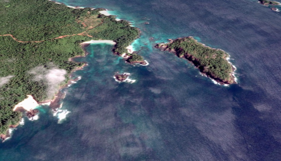
Anchorage
Panama
Approach
◬ 8° 48.5026 N 79° 33.2803 W
Depth
20.0 ft
6.6 m
Bottom Composition
S - Sand
Aids to Navigation
Depth Contours
Land
Shore Access
Beach
Notes

Use this anchorage if "southerlies" develop - also good in Easterlies

Dangers
Swell
Wind Exposure
N NE NW
Swell Exposure
N NE NW
Amenities
Town
Date & Time Visited
1999-12-12T12:00:00
Anonymous
Anchorage
Panama
Pedro González Anchorage
Depth
15.0 ft
4.5 m
Bottom Composition
S - Sand
Aids to Navigation
Depth Contours
Land
Shore Access
Beach
Notes

Danger Outboard Thefts here !!!

15' sand. Gasoline, some provisions.
Rafael helped us with findong various
tiendas.

Reanchor for suitable conditions

Dangers
Theft and Petty Crime Area
Wind Exposure
N NE E
Swell Exposure
N NE E
Date & Time Visited
2012-12-12T12:00:00
Anonymous
Anchorage
Panama
Pedro Gonzales - SE
Approach
◬ 8° 23.5111 N 79° 7.7640 W
Depth
17.0 ft
3.4 m
Bottom Composition
S - Sand
Aids to Navigation
Depth Contours
Land
Shore Access
Beach
Notes

Sand and some rock 17' "0" tide

Dangers
Rocks
Wind Exposure
SE S SW
Swell Exposure
SE S SW W
Date & Time Visited
2012-12-12T12:00:00
Anonymous
Anchorage
Panama
Isla Mogo Mogo - S
Approach
◬ 8° 34.2107 N 79° 0.5474 W
◬ 8° 34.0503 N 79° 0.8319 W
◬ 8° 33.8619 N 79° 1.0353 W
◬ 8° 33.7511 N 79° 1.2593 W
◬ 8° 33.7231 N 79° 1.4241 W
◬ 8° 33.7919 N 79° 1.4872 W
◬ 8° 33.8084 N 79° 1.4859 W
Bottom Composition
S - Sand
Aids to Navigation
Depth Contours
Land
Shore Access
Beach
Notes

9.5" sandy spots at zero low tide. Enter at
LW only!! Only for calm conditions

Dangers
Swell
Rocks
Wind Exposure
NE E SE S SW W
Swell Exposure
NE E SE S SW W
Date & Time Visited
2012-12-12T12:00:00
Anonymous
Anchorage
Panama
Wreck of the Sub Marine Explorer - Anchorage
Depth
17.0 ft
5.6 m
Bottom Composition
S - Sand
R - Rocky
Co - Coral
Aids to Navigation
Depth Contours
Land
Shore Access
Beach
Notes

17' temp anchorage sand and rock

Dangers
Small Wreck
Wind Exposure
N NE W NW
Swell Exposure
NE W NW
Amenities
Point of Interest
Wreck
Date & Time Visited
2012-12-12T12:00:00
Anonymous
Anchorage
Panama
Hacienda del Mar Anchorage
Depth
15.0 ft
4.6 m
Bottom Composition
S - Sand
Co - Coral
Aids to Navigation
Depth Contours
Land
Shore Access
Beach
Dangers
Reef
Rocks
Wind Exposure
SE S
Swell Exposure
SE S
Amenities
Hotel
Date & Time Visited
2012-12-12T00:00:00
Anonymous
Anchorage
Panama
Isla San Jose - SE
Depth
21.0 ft
Bottom Composition
S - Sand
Aids to Navigation
Depth Contours
Land
Shore Access
Beach
Notes

21' 0 water. sand with little rubble.

Dangers
Rocks
Wind Exposure
E SE S
Swell Exposure
E SE S
Date & Time Visited
2012-12-11T00:00:00
Anonymous
Anchorage
Panama
Approach
◬ 8° 12.5743 N 79° 7.0386 W
Depth
15.0 ft
4.6 m
Bottom Composition
S - Sand
R - Rocky
Aids to Navigation
Depth Contours
Land
Shore Access
Beach
Notes

15' 0 water rocky bottom. . Entrance 20' watch out for rock
west side of anchorage. Enter from Isla Hicaco side only.
Numerous reefs directly S-SW of Anchorage out about 200
yds

Dangers
Rocks
Reef
Wind Exposure
SW
Swell Exposure
SW
Date & Time Visited
2012-12-12T12:00:00
Anonymous
Anchorage
Panama
Punta Canal Aguja
Approach
◬ 8° 22.7937 N 78° 50.3358 W
◬ 8° 22.3158 N 78° 50.4135 W
◬ 8° 22.7937 N 78° 50.3358 W
Depth
15.0 ft
4.5 m
Bottom Composition
S - Sand
Aids to Navigation
Depth Contours
Land
Shore Access
Beach
Notes

wait for high water headed south

Dangers
Tide
Tidal Flow
Wind Exposure
SW
Swell Exposure
SW
Date & Time Visited
2012-12-12T12:00:00
Anonymous