Anchorage
Mexico - Pacific
Depth
20.0 ft
6.1 m
Bottom Composition
S - Sand
Aids to Navigation
Depth Contours
Land
Dangers
Swell
Wind Exposure
SE S SW
Swell Exposure
SE S
Amenities
Dive Site
marina
Anchorage
Mexico - Pacific
Depth
20.0 ft
6.1 m
Bottom Composition
S - Sand
Aids to Navigation
Depth Contours
Land
Shore Access
Beach
Notes

unsurveyed

Dangers
Swell
Rocks
Unsurveyed Area
Wind Exposure
S SW W
Swell Exposure
S SW W
Amenities
Dive Site
marina
Anchorage
Mexico - Pacific
Isla Socorro - E
Depth
20.0 ft
6.1 m
Bottom Composition
S - Sand
Aids to Navigation
Depth Contours
Land
Shore Access
Beach
Dangers
Swell
Wind Exposure
E SE S SW
Swell Exposure
E SE S SW
Amenities
Dive Site
marina
Anchorage
Belize
Depth
8.0 ft
2.4 m
Bottom Composition
S - Sand
Aids to Navigation
Depth Contours
Land
Lights
Shore Access
Beach
Notes

Superb Dive Site - nice Protection

Dangers
Reef
Wind Exposure
S SW W NW
Swell Exposure
S SW W NW
Amenities
Dive Site
marina
Anchorage
Mexico - Pacific
Approach
◬ 25° 29.5747 N 111° 0.4754 W
Depth
13.0 ft
3.9 m
Bottom Composition
S - Sand
Aids to Navigation
Depth Contours
Land
Shore Access
Beach
Notes

Tucked in the lee of Punta San Marte the Punta San Marcial anchorage provides great shelter from southwest through to the north. However this is not a good anchorage in the wet season as it is open to the south and east.

Approaches

Reefs extend almost 1NM southeast of Punta Marte on the northern side of the bay.

Anchorage

Anchor off the white sand beach tucked in carefully behind the reef in 3.9m on sand. Landing the dinghy ashore can be hazardous when the swell is running.

Facilities

None. Snorkeling or diving on the reef off Punta San Marte is surprisingly good.

Dangers
Uncharted Rocks
Misscharted Rocks or Boulders
Swell
Wind Exposure
NE E SE S
Swell Exposure
NE E SE S
Amenities
Dive Site
marina
Anchorage
Mexico - Pacific
Playa las Monas
Isla Isabel East
Approach
◬ 21° 50.8857 N 105° 52.7470 W
◬ 21° 50.8284 N 105° 52.6685 W
◬ 21° 50.8326 N 105° 52.5314 W
◬ 21° 51.0034 N 105° 52.2771 W
Depth
34.0 ft
10.3 m
Bottom Composition
S - Sand
Aids to Navigation
Depth Contours
Land
Shore Access
Beach
Notes

The anchorage on the east side of Isla Isabella is a roadstead anchorage with no protection from the prevailing northerlies or summer southerlies. It is exposed to the swell from all directions but west. This is a rolly anchorage with poor holding and little chance of a good nights rest.

Approaches

No info.

Anchorage

The bottom is strewn with rocks but it is sandier close to Isla Mono Menor where you can anchor in 5-10m. The holding is poor. Isla Isabella has a reputation for eating anchors so use a trip line to avoid getting your anchor swallowed. The beach is stony in places so find a sandy patch to land the dinghy. Be very cautious approaching the beach if the swell is running.

Facilities

None. The island offers great hiking and bird watching. A trail leads from the beach to the crater lake but the entrance is difficult to find. There’s no need to walk anywhere to see nests of both blue-footed and green-footed boobies lining the pebble beach just above the tide line. These strikingly attractive birds are related to gannets and are superb divers. They nest on the ground and the males and females take turns to sit on the egg while the partner fishes. The blue-footed boobies perform a strange courtship dance together, lifting first one foot then another off the ground and raising their tails – fascinating to watch!

Dangers
Rocks
Swell
Wind Exposure
N NE E SE S
Swell Exposure
N NE E SE S
Amenities
Park or Nature Preserve
Dive Site
Carinthia
Anchorage
Costa Rica
Playa Guacamaya
Approach
◬ 10° 31.4185 N 85° 47.7178 W
Depth
18.0 ft
5.7 m
Bottom Composition
S - Sand
Aids to Navigation
Depth Contours
Land
Shore Access
Beach
Notes

Bahia Guacamaya is located just north of Punta Zapotal about 8NM west of Playas del Coco. The calm anchorage, secluded beaches and crystal clear water make this a enjoyable spot to linger for a few days or shelter from papagayos.

Approaches

Reefs extend off the NW point at the entrance to Bahia Guacamaya and should be given a wide berth. Enter the bay on the northeastern side to avoid a reef reported in the centre of the bay. The charts on both OpenCPN and Navionics are reported to be inaccurate in this area.

Anchorage

The western shore of the bay is rocky but tucking up in the NE corner of offers protection from the wind and waves from almost all directions. Anchor in 5.7m on a sandy bottom with good holding. Shore access by dinghy to the beach.

Facilities

None. Great reefs for snorkeling and diving.

Dangers
Swell
Underwater Rocks
Wind Exposure
N W NW
Swell Exposure
N W NW
Amenities
Dive Site
Date & Time Visited
2018-04-08T11:11:11
Anonymous
Anchorage
Costa Rica
Isla del Caño
Depth
22.0 ft
6.7 m
Bottom Composition
S - Sand
Co - Coral
Aids to Navigation
Depth Contours
Land
Shore Access
Beach
Notes

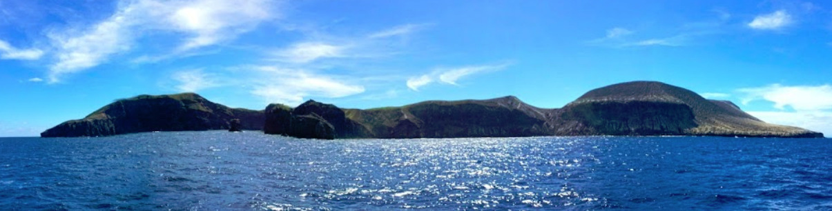
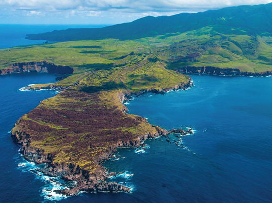
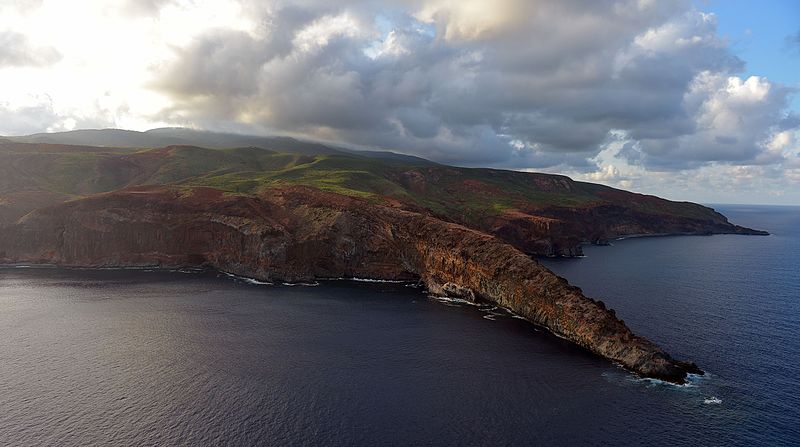
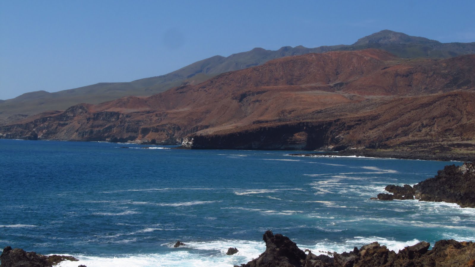
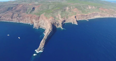
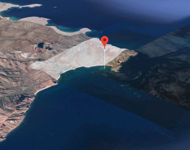
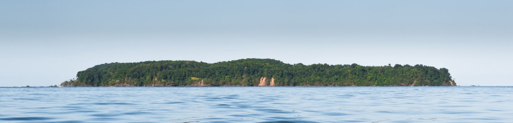
Isla del Caño (or Cane Island) is a biological reserve located about 12NM northwest of Drake Bay on the Osa Peninsula. This is a day anchorage only, you are not allowed to stay overnight in the land and marine area of the reserve. Anchorage is possible on either side of the island, depending upon the weather and swell conditions. Neither site offers much protection from the wind.

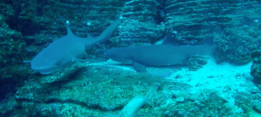
The island is a breeding site for humpback whales from both the northern and southern hemispheres, as well as a resident species of dolphins. The crystal clear waters  are home to turtles, dolphins, stingrays, manta rays, moray eels as well as a variety sharks and humpback or pilot whales and some gorgeous coral reefs.

In Pre-Columbian times Isla del Caño was a burial ground for the Chiriqui people and it is possible to find strange stone spheres in the jungle which are hand carved and perfectly rounded and were related to their rituals.

Approaches

No info

Anchorage

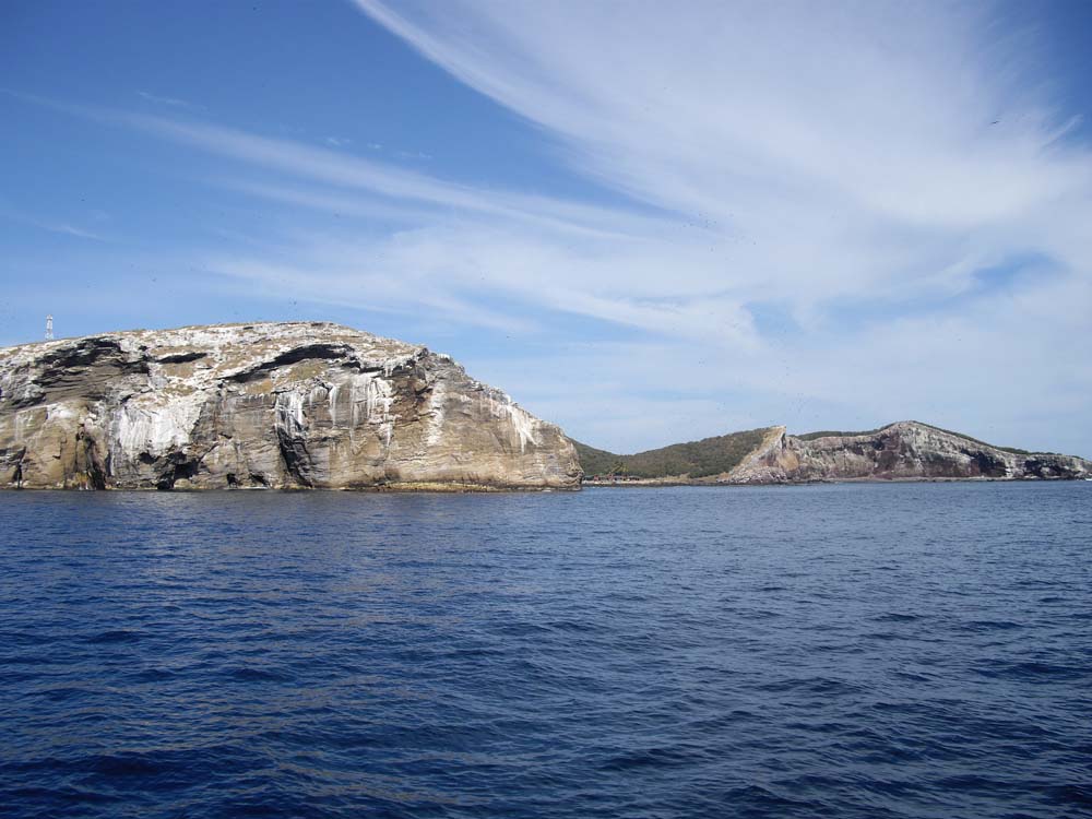
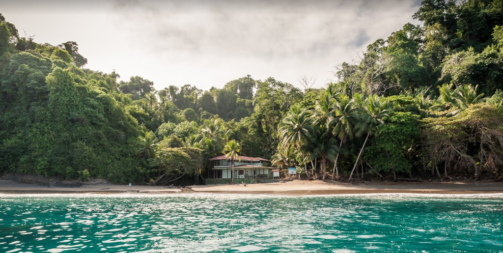
You will not be allowed to visit Isla del Caño without a permit which must be procured in advance and will be requested by the rangers. Anchoring is not permitted. Moorings are located off the main beach at the NW side of the island in front of the park headquarters but they may be full of tour boats. Take care taking the dinghy ashore if the swell is breaking on the reef.

Facilities

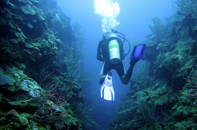
None. Snorkeling and scuba diving are allowed only in the areas designated for diving which are marked by buoys. A maximum of ten people including divers from tour boats can be in the designated diving area at the same time.

There are two walking trails on Caño Island departing from behind the ranger station. The path splits leading to either an archaeological site in the centre of the island or a view point on the south coast. Hike only on the trails designated for public use and be accompanied by a certified guide.

Dangers
Lightning
Swell
Rocks
Tour Boats
Wind Exposure
N NE E W NW
Swell Exposure
N NE W NW
Amenities
Dive Site
Park or Nature Preserve
Historic Site
Snorkeling
Hiking Trail
Anonymous