Anchorage
Costa Rica
Depth
25.0 ft
5.7 m
Bottom Composition
S - Sand
M - Mud
Aids to Navigation
Depth Contours
Land
Shore Access
Beach
Notes

Isla Caballo is the eastern of the two long islands lying 3.9NM northwest of Punta Naranjo. The anchorage on the southern side is well protected from the north and is calm except when strong southerly winds are blowing.

Approaches

No info

Anchorage

Anchor in 5.7m with good holding in mud.

Facilities

None.

Dangers
Tidal Range
Wind Exposure
S SW W
Swell Exposure
S SW W
Anonymous
Anchorage
Costa Rica
Playa Naranjo
Oasis Resort
Depth
17.0 ft
5.8 m
Bottom Composition
S - Sand
M - Mud
Aids to Navigation
Depth Contours
Land
Shore Access
Beach
Dock
Notes

Punta Naranjo lies 7NM west of Puntarenas and is the northern port for ferries arriving from the mainland to the Nicoya Peninsula. The small bay is open to the north and can be choppy in a strong northerly. In calm conditions Punta Naranjo is a good location to leave the boat and take the ferry to Puntarenas for provisioning.

Approaches

No info

Anchorage

Anchor on either side of the dock in 5.8m of muddy sand. Shore access is by dinghy to the beach or the pier. There is also a small beach to take the dinghy into on the east side of the ferry dock.

Facilities

There is no town at Punta Naranjo although several hotels and restaurants are dotted about the area. The bar and restaurant at the Hotel O’Pacifico have free wifi, ask the staff about laundry, garbage disposal and the possibility of potable water.

The ferry dock lies 1km west of the bay and ferries leave for Puntarenas four times daily.

Dangers
Ferry Traffic
Strong Current
Tidal Range
Wind Exposure
N NE NW
Swell Exposure
N NE NW
Amenities
Restaurant
Bar
Hotel
Date & Time Visited
2018-03-28T11:11:11
Anonymous
Anchorage
Costa Rica
Depth
16.0 ft
5.3 m
Aids to Navigation
Depth Contours
Land
Shore Access
Beach
Notes

Bahia Luminosa lies in the same bay as Isla Muertos about 4NM north of Paquera. The bay is open to the east but Isla Muertos offers some protection from northerly winds.

Approaches

No info

Anchorage

Anchor off the beach in 5.3m on sand and mud. Shore access is by dingy to the beach.

Facilities

None. The Bahia Luminosa resort, closed since 2009 was rumoured to have re-opened in 2012.

Dangers
Tidal Range
Wind Exposure
N NE E
Swell Exposure
N E
Anonymous
Anchorage
Costa Rica
San Marcos
Depth
8.0 ft
2.5 m
Bottom Composition
S - Sand
Cy - Clay
Aids to Navigation
Depth Contours
Land
Shore Access
Beach
Dock
Notes

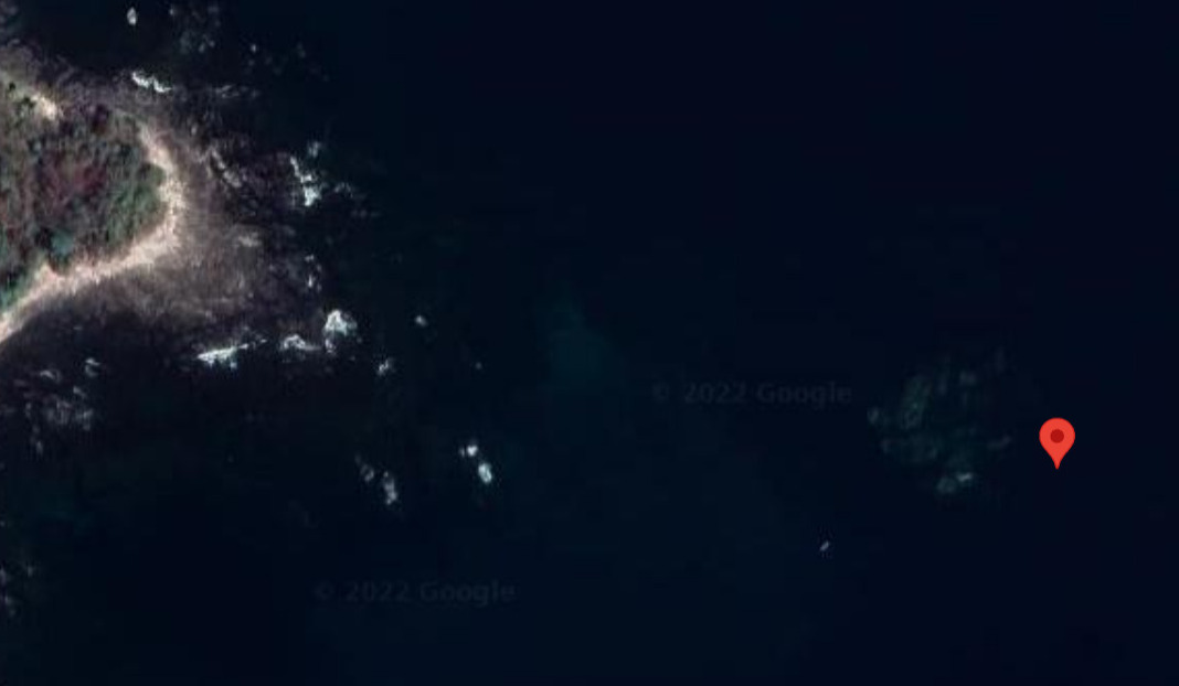
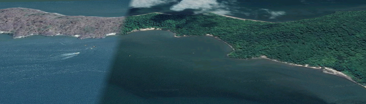
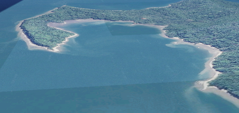
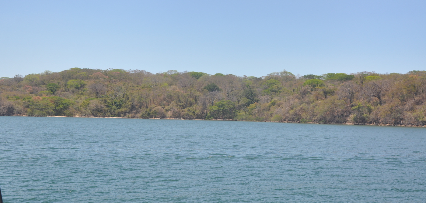
On the west side of Golfo de Nicoya Isla San Lucas lies opposite the large town of Puntarenas on the mainland. Crossing the 3.8NM to the town can be hazardous in a dinghy as the strong northerly winds can kick up a stiff choppy sea. The large bay on the east side of the island is shoal close to the beach but is a very calm anchorage.

The island had been a penal colony from the time of the conquistadors in the 16th century and served as Costa Rica’s Alcatraz until it was finally abandoned in 1991. The prison is deserted and the buildings are open to look around. Around seven hundred inmates were incarcerated for life in seven cell blocks ringed a semicircular courtyard underlain by a huge cistern with two holes in the roof. The graffiti on the cell blocks features religious images or naked women as well as a host of other things that the prisoners were longing for.

Tourist boats arrive from the mainland for a tour of the prison, otherwise you will have the bay to yourself. The haunting calls of the howler monkeys, the eerie buildings and the accumulation of human anguish make this a memorable anchorage.

Approaches

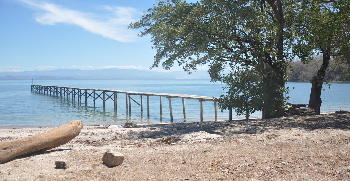
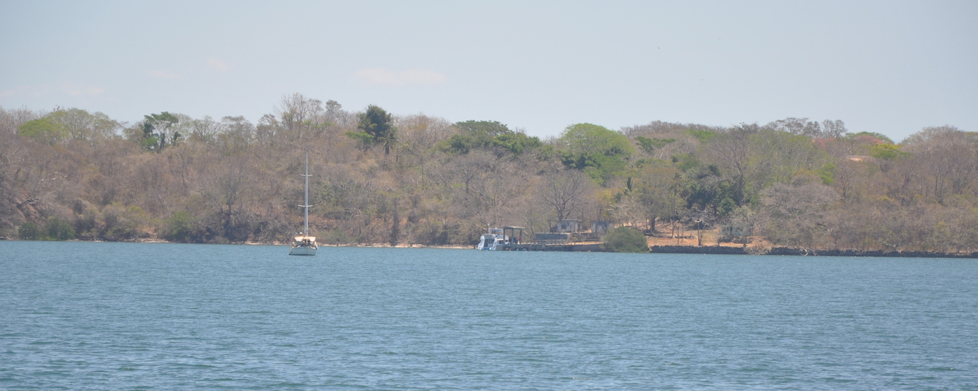
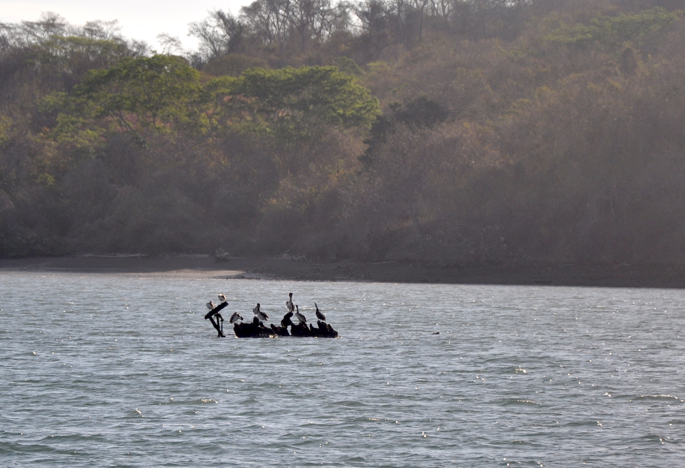
On entering the bay favour the southern side and head towards the dock in the southeast corner. A wreck lying in the centre of the bay is visible at low tide.

Anchorage

Anchor off the dock in 2.5m on a sandy clay bottom with good holding. Dinghy in to the steps on the side of the dock or land on the beach where there is a rubbly path up to a track which leads to the dock and prison.

Facilities

None. Visiting the prison is a fascinating experience. There are also several tracks on the island for hiking.

Dangers
Small Wreck
Tour Boats
Wind Exposure
SW
Swell Exposure
SW W
Amenities
Historic Site
Date & Time Visited
2018-03-27T11:11:11
Anonymous