Anchorage
Solomon Islands
Depth
72.0 ft
22.0 m
Bottom Composition
S - Sand
Aids to Navigation
Land
Depth Contours
Shore Access
Beach
Dock
Wind Exposure
N NE E NW
Swell Exposure
N NE E NW
Date & Time Visited
2014-06-15T10:45:00
editor
Anchorage
Solomon Islands
Depth
33.0 ft
10.0 m
Bottom Composition
S - Sand
Aids to Navigation
Land
Depth Contours
Local Marks
Shore Access
Beach
Wind Exposure
N NE SW W NW
Swell Exposure
N NE SW W NW
Date & Time Visited
2014-06-15T10:45:00
editor
Anchorage
Solomon Islands
Depth
16.0 ft
5.0 m
Bottom Composition
S - Sand
Aids to Navigation
Land
Depth Contours
Shore Access
Beach
Wind Exposure
SE S SW W NW
Swell Exposure
SE S SW W NW
Date & Time Visited
2014-06-15T11:15:00
editor
Anchorage
Solomon Islands
Depth
49.0 ft
15.0 m
Bottom Composition
Co - Coral
S - Sand
Aids to Navigation
Land
Depth Contours
Local Marks
Shore Access
Beach
Wind Exposure
N NE E SE
Swell Exposure
N NE E SE
Date & Time Visited
2014-06-15T11:00:00
editor
Anchorage
Solomon Islands
Depth
26.0 ft
8.0 m
Bottom Composition
S - Sand
Aids to Navigation
Buoys
Local Marks
Depth Contours
Land
Shore Access
Beach
Wind Exposure
N NE NW
Swell Exposure
N NE NW
Date & Time Visited
2014-06-15T14:15:00
editor
Anchorage
Solomon Islands
Depth
23.0 ft
7.0 m
Bottom Composition
Co - Coral
S - Sand
Aids to Navigation
Land
Depth Contours
Local Marks
Shore Access
Beach
Notes

W shore of Njae Passage, is Seghe; currents run at up to 2kts in the Passage. We anchored 150m north of the village wharf (which in turn is close to the airport runway's east end). In a strong norther this could be a little exposed, in which case it would be better to cross the channel to the twin village of Patutiva. Seghe has two shops (by the wharf) and a small market (also by the wharf ѓ?? it does not function on weekends). The airport has regular flights to Gizo and Honiara; the Pelican Express passenger ferry calls here; there is a small hospital; cellphone coverage; the town generator was ѓ??outѓ?ќ at the time of our visit so hoped-for cold beers and ice cream were not available. The village, which is United Church (Methodist) is of modern construction. Divers often dive on a plane wreck (P38 fighter) just off the end of the runway.

Wind Exposure
N SE S
Swell Exposure
N S
Date & Time Visited
2014-06-15T14:30:00
editor
Anchorage
Solomon Islands
Depth
59.0 ft
18.0 m
Bottom Composition
Co - Coral
S - Sand
Aids to Navigation
Land
Depth Contours
Local Marks
Shore Access
Beach
Wind Exposure
N NE SE S SW NW
Swell Exposure
N NE SE S SW NW
Date & Time Visited
2014-06-15T14:30:00
editor
Anchorage
Solomon Islands
Depth
33.0 ft
10.0 m
Bottom Composition
M - Mud
S - Sand
Aids to Navigation
Land
Depth Contours
Local Marks
Shore Access
Beach
Notes

The entrance to Viru Harbour is between high cliffs; it is deep but could be daunting in a heavy S or

Wind Exposure
SW
Swell Exposure
SW
Date & Time Visited
2014-06-15T18:15:00
editor
Anchorage
Solomon Islands
Depth
13.0 ft
3.5 m
Bottom Composition
S - Sand
Aids to Navigation
Depth Contours
Land
Shore Access
Beach
Notes

Kate Glover: We used fore and aft anchors to keep us from sliding down the steep slope. Saw a few crocodiles, but still had great snorkeling. Tons of bumphead parrotfish and great visibility. Nice walk to the crocodile lake. The rangers can tell you about some other spots you can anchor as well. We loved Tetepare, and would highly recommend it. If you go to the islands nearby, make sure you tell them how much you liked Tetepare so they know it's bringing people in their direction (there seems to be some contention among the descendants b/c it's not possible to give all of them jobs or scholarships, so they don't all see the tangible benefits they want to seeѓ??it's good to let them hear you're interested in the leatherbacks and the standing trees).

Wind Exposure
N NW
Swell Exposure
N NW
Date & Time Visited
2013-10-12T13:31:00
editor
Anchorage
Solomon Islands
Depth
33.0 ft
10.0 m
Bottom Composition
S - Sand
Aids to Navigation
Depth Contours
Land
Local Marks
Shore Access
Beach
Tidal Reef
Notes

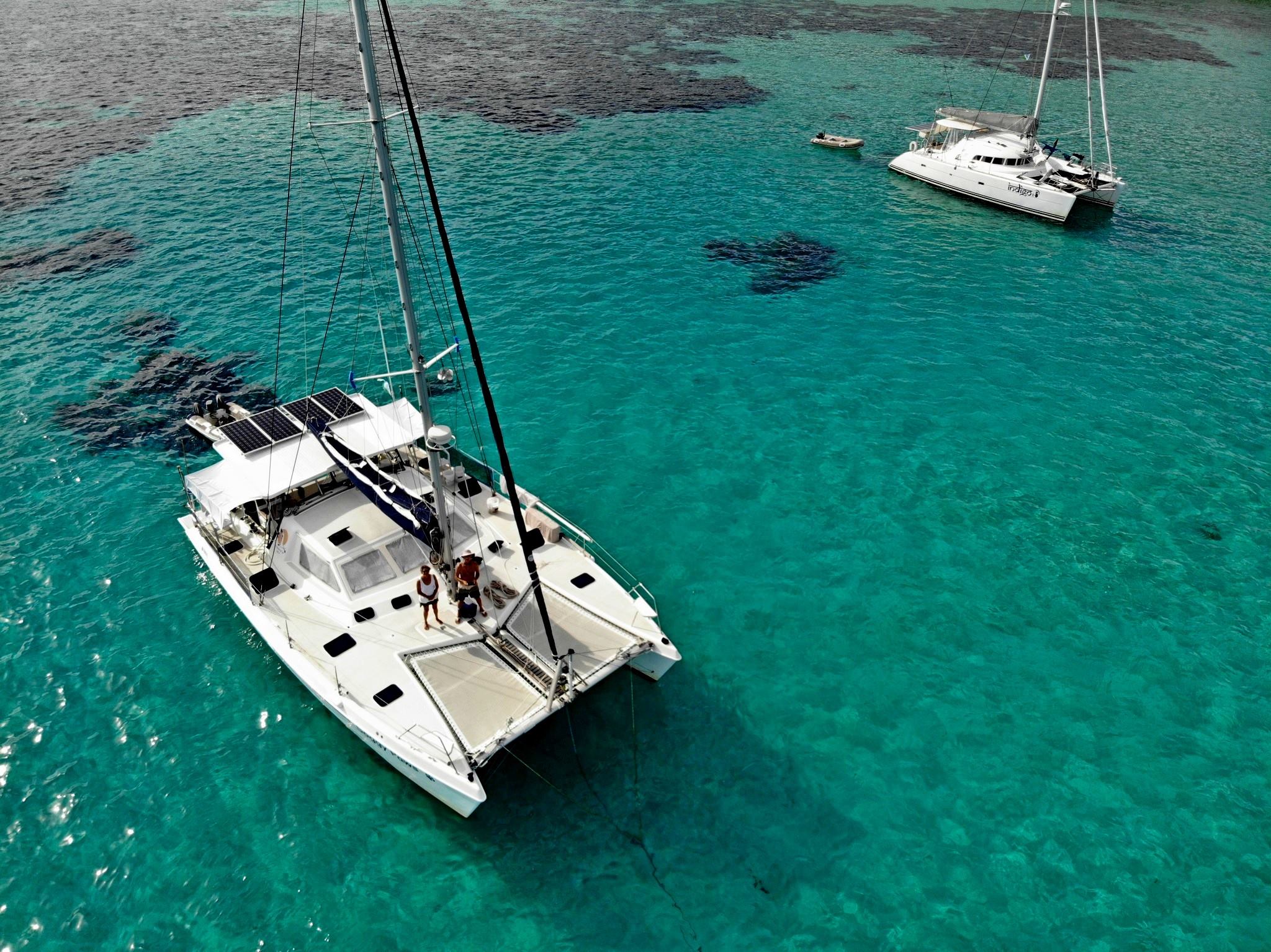
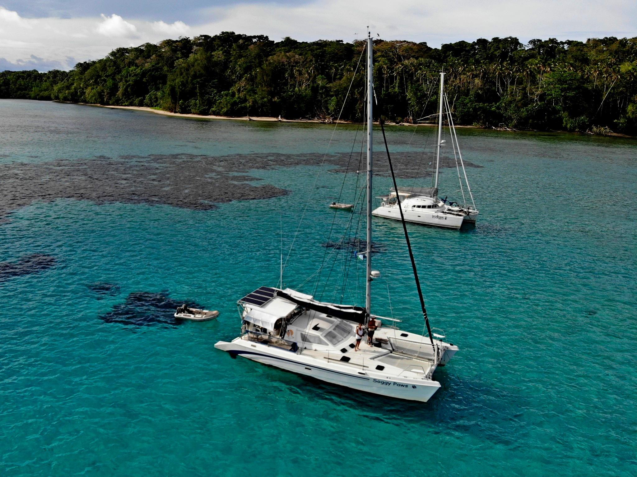
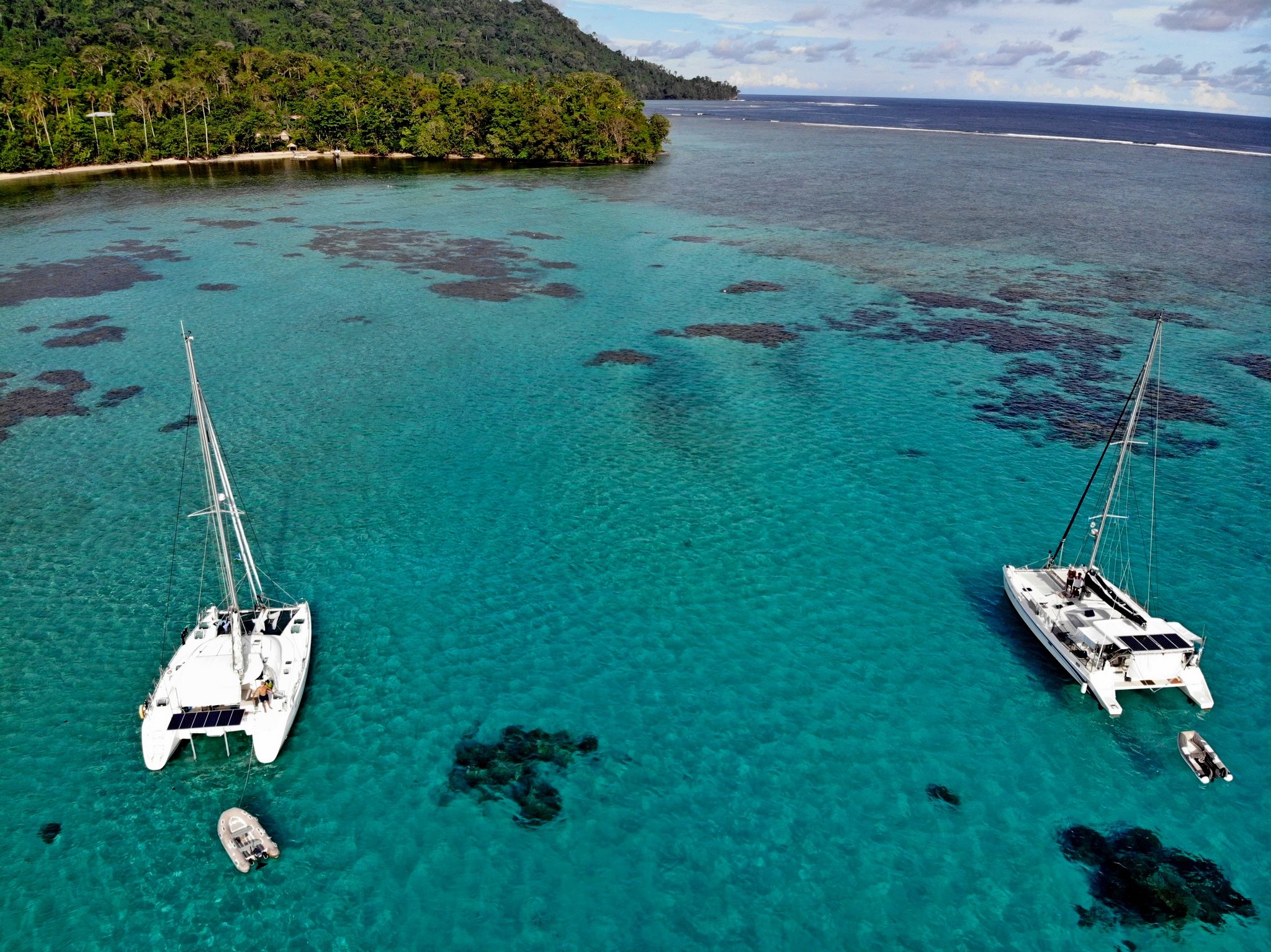
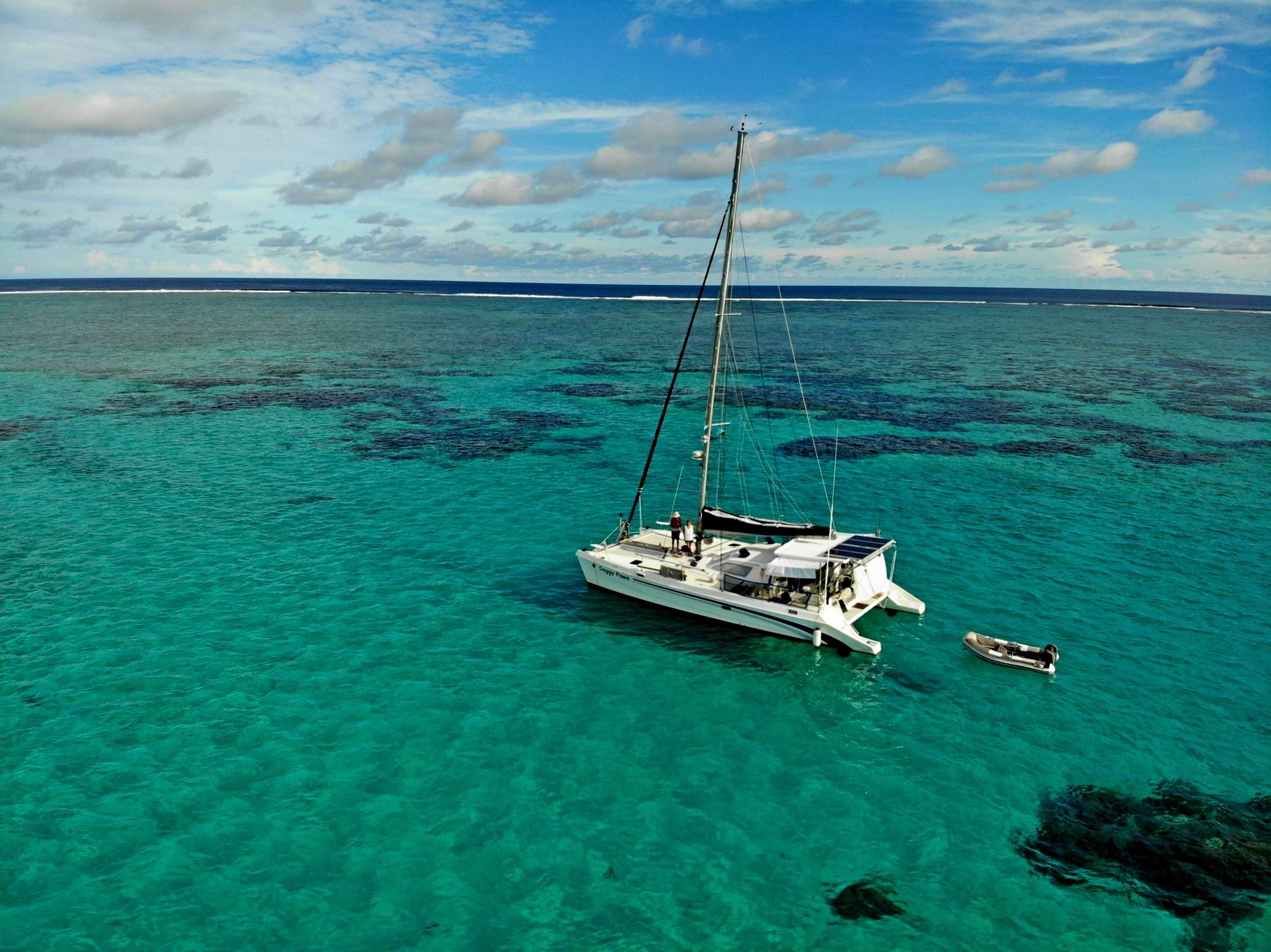
By Kate Glover : The lodge is in the lagoon on the far southwest side of the island, just around the western corner from Waugh Bay. The pass into the lagoon is not super-obvious until you know where it is, though it can be seen on Google Earth. If you circle at the entrance for a bit, the rangers may come out and guide you in (they led us in and showed us where they wanted us to anchor) You'll see a barrel (actually, it's just a mesh bag full of Styrofoam) ahead of you. As you enter keep the barrel to your right. The channel then is narrow, but it's plenty deep and pretty clear. It's pretty obvious where it starts to get shallow. You will pass between two large bommies, and then you get to a shallow, sandy patch. That's where you anchor. There is a strong current in the lagoon (and it's always going out), and it's a relatively small spot, so we set a stern anchor to keep from running into coral heads. It was about 10 feet deep, but a consistent depth in the sandy area, Awesome snorkeling right off the boat. If the wind picked up and got too strong, you could move over to Waugh Bay. It's an easy walk from Waugh Bay to the lodge (and Waugh Bay also has great snorkeling). The fees, in 2013, were $100 SBD per person for a conservation fee, and $250 SBD for a mooring fee (though I'm not certain the mooring fee is the same for every boat)


PICTURES BY Sherry McCampbell

Wind Exposure
S SW W NW
Swell Exposure
NW
Date & Time Visited
2013-10-17T13:15:00
editor