Anchorage
Costa Rica
Playa Guacamaya
Approach
◬ 10° 31.4185 N 85° 47.7178 W
Depth
18.0 ft
5.7 m
Bottom Composition
S - Sand
Aids to Navigation
Depth Contours
Land
Shore Access
Beach
Notes

Bahia Guacamaya is located just north of Punta Zapotal about 8NM west of Playas del Coco. The calm anchorage, secluded beaches and crystal clear water make this a enjoyable spot to linger for a few days or shelter from papagayos.

Approaches

Reefs extend off the NW point at the entrance to Bahia Guacamaya and should be given a wide berth. Enter the bay on the northeastern side to avoid a reef reported in the centre of the bay. The charts on both OpenCPN and Navionics are reported to be inaccurate in this area.

Anchorage

The western shore of the bay is rocky but tucking up in the NE corner of offers protection from the wind and waves from almost all directions. Anchor in 5.7m on a sandy bottom with good holding. Shore access by dinghy to the beach.

Facilities

None. Great reefs for snorkeling and diving.

Dangers
Swell
Underwater Rocks
Wind Exposure
N W NW
Swell Exposure
N W NW
Amenities
Dive Site
Date & Time Visited
2018-04-08T11:11:11
Anonymous
Anchorage
Costa Rica
Depth
18.0 ft
5.8 m
Bottom Composition
S - Sand
M - Mud
Aids to Navigation
Depth Contours
Land
Shore Access
Beach
Notes

At the east end of Bahia Culebra Playa Iguanita is undeveloped and rarely visited by day trippers. The stunning white sand beach is a wildlife refuge dedicated to conserving the mangroves and fauna while ensuring that the beach remains available to the general public.

Approaches

No info

Anchorage

Anchor in 6m on a sandy bottom. The anchorage is sheltered from the prevailing NE-SE winds but the swell from the SW can cause it to be rolly.

Facilities

None

Wind Exposure
SW W NW
Swell Exposure
SW W NW
Anonymous
Anchorage
Costa Rica
Depth
15.0 ft
4.7 m
Bottom Composition
S - Sand
Aids to Navigation
Depth Contours
Land
Shore Access
Beach
Notes

The anchorage lies off the southwestern tip of Isla Cedros between Isla Jesusita and the mainland. Aquaculture is being developed in the area and there are several fish pens in the bay.

Approaches

Power lines between the mainland and Isla Cedros, and Isla Cedros and Isla Jesusita restrict entrance to this anchorage from the east.

Anchorage

The centre of the inlet is deep but anchorage can be taken close to the shore of any of the islands. Do not anchor near the water pipeline which runs from the bay marked “Pulperia” in Navionics on the mainland to the SW end of Isla Cedros.

Facilities

There is a glamping hotel at the west end of Isla Jesusita.

Dangers
Tidal Range
Overhead Limits
Rocks
Underwater Rocks
Ferry Traffic
Wind Exposure
SW W NW
Amenities
Resort
Campground
Anonymous
Anchorage
Costa Rica
Playa Garza
Approach
◬ 9° 54.1412 N 85° 38.5907 W
◬ 9° 53.9313 N 85° 38.6174 W
◬ 9° 53.3280 N 85° 38.7180 W
Depth
15.0 ft
4.8 m
Bottom Composition
S - Sand
Aids to Navigation
Depth Contours
Land
Shore Access
Beach
Notes

Bahia Garza is small bay located on the east side of Punta Guiones, 8.5NM west of Samara. The bay is open to the south and hence to the swell making it a rolly anchorage. However Bahia Garza is a good place to shelter from papagayos.

Approaches

Stay at least 3.3NM off Punta Guiones as reefs extend a long way from the headland. Enter the bay from the south passing to the west of the reef in the centre of the bay.

Anchorage

Keep clear of the pangas and anchor behind the reef in 4.8m on a sandy bottom. Use a stern anchor to keep the bow pointing into the swell. The western end of the beach may be more sheltered from the waves but take care landing the dinghy.

Facilities

The bay has a campsite, restaurant and minimart. It is an 8km bus ride to the town at Playa Guiones which hosts plenty of hotels, restaurants, a grocery store and a gas station.

Dangers
Swell
Rocks
Reef
Moorings
Wind Exposure
SE S SW
Swell Exposure
SE S SW
Amenities
Settlement
Campground
Grocery Store
Date & Time Visited
2018-03-11T11:11:11
Anonymous
Anchorage
Costa Rica
Approach
◬ 10° 34.0382 N 85° 42.7114 W
Depth
18.0 ft
5.0 m
Bottom Composition
S - Sand
Aids to Navigation
Depth Contours
Land
Shore Access
Beach
Notes

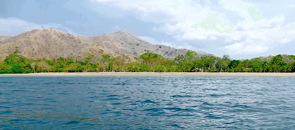
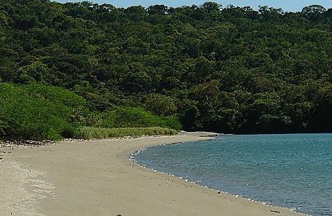
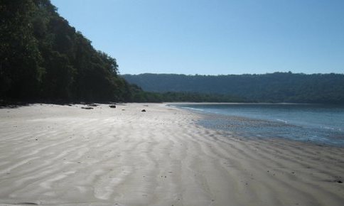
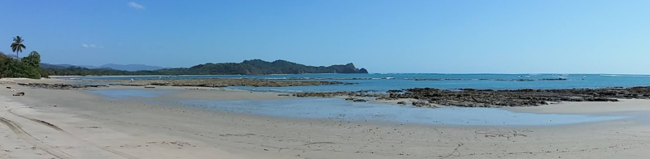
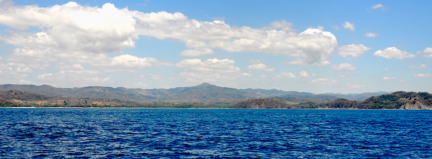
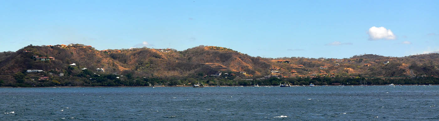
Playas del Coco is the northern port of entry for Costa Rica and is the tourism hub for the Guancaste area. Visitors and foreign residents are attracted to the area by the superb beaches, diving and surfing and use Playas del Coco as a base for exploring the region. However under Costa Rican law a fifty metre zone from the high tide is designated as public land and no buildings of any kind can be constructed there. As a result the coastline is largely uncluttered with tourist development preserving the beauty of the natural shore.

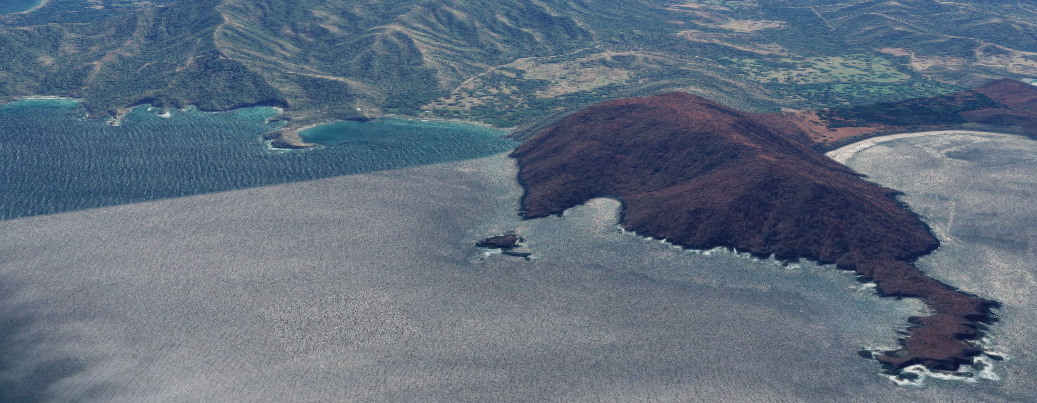
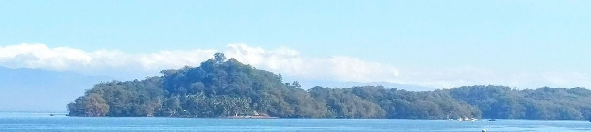
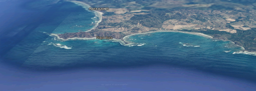
The horseshoe shaped bay is guarded by a reef to the west and by Punta Cacique and the Islas Pelonas to the north ensuring a sheltered anchorage even in Papagayo conditions.

Approaches

No info

Anchorage

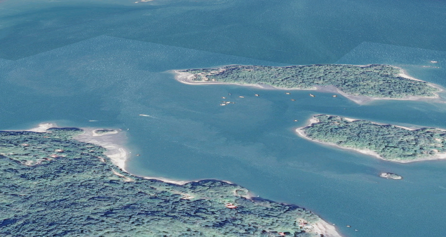
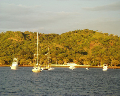
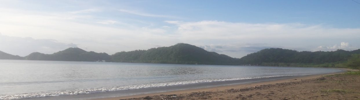
The bay is crowded with local boats and moorings but anchorage can be taken on the west side in 5-10m on sand. The anchorage is sheltered from the prevailing NE-SE winds but the southerly swell can wrap around into the bay and cause it to be rolly.

Watch out for a shallow reef in the centre of the bay just east of the rivermouth. It is exposed at low tide. Go back out to deeper water to move between the north and the south anchorages - do not try crossing the reef.

Shore access is by dinghy to the beach. Pull up near the old pier to access the Port Captain and the centre of town. Care must be taken when the surf is breaking on the beach. It is recommended to secure your dinghy to a tree. Alternatively call a local panga captain ( Giovanni ) at +506 8743 5445 or a watertaxi +506 8830 9626 to take you to the beach. They will pick you up for a tip ~ $5 USD.

Facilities

This busy tourist town has a bank, several well-stocked supermarkets, plenty of bars and eateries and even a casino (which has the best wifi in town). The 2.5km beach is great for walking and snorkeling around the islands in the bay is very scenic. Nature, diving and snorkeling tours are available here.

The mains water in Costa Rica is potable. Water is available at taps dotted along the malecon behind the beach and some also have outdoor showers. However with three metre tides and breaking surf getting jerry cans into the dinghy can be a bit of a workout. Similarly fuel purchased at the gas station in the town needs to lugged in jerrys back to the dinghy. Propane is not available in town but is a long taxi to a station 6km beyond Liberia airport.

Dangers
Rocks
Reef
Dinghy / Outboard Theft
Wind Exposure
N NW
Swell Exposure
N NW
Amenities
Town
Date & Time Visited
2005-05-03T05:59:00
editor
Anchorage
Costa Rica
Approach
◬ 9° 51.5920 N 85° 31.7036 W
◬ 9° 51.7595 N 85° 31.4718 W
◬ 9° 51.8863 N 85° 31.1603 W
◬ 9° 51.9751 N 85° 30.8950 W
◬ 9° 52.0461 N 85° 30.7199 W
◬ 9° 52.1070 N 85° 30.6556 W
Depth
15.0 ft
4.7 m
Bottom Composition
S - Sand
Aids to Navigation
Depth Contours
Land
Shore Access
Beach
Notes

Bahia Samara is located about halfway down the remote west coast of the Nicoya Peninsula about 40NM from Tamarindo. The bay is open to the south however the reefs break up the swell to some extent. Although it is a rolly anchorage many cruisers stop here to break the passage between Golfo de Nicoya and Playas del Coco.

Despite being well established on the tourist trail the town of Samara still retains a laid back, unhurried atmosphere. The palm lined beach stretches for several miles and is dotted with bars and tiki restaurants and at the east end Isla Chora boasts pink sand and plenty of birdlife.

Approaches

The bay at Samara is protected by reefs which extend from both sides almost closing off the entrance. Enter at low tide if possible to help locate the reefs and carefully navigate between them. It would be hazardous to enter Bahia Samara for the first time in poor visibility or at night.

Anchorage

Anchorage can be taken behind the reef on either side of the Bahia Samara but stay at least 0.25NM off the beach as the bay shoals rapidly. It may be necessary to anchor several times before finding a spot where the swell is bearable. At the east side of the bay anchor behind Isla Chora in 4.7m on a sandy bottom. The island reduces some of roll but the swell also diffracts through the gap with the mainland.

The beach at the east end of the bay is the safest place to take the dinghy ashore but it is a long walk to the town which lies on the 3.5km away on the NW side of the bay. Alternatively dinghy across to the river mouth just to the west of the town but take care approaching the shore if waves are breaking on the beach.

Facilities

At the eastern end of the bay several restaurants and a supermarket are within walking distance of the beach. The town of Samara has numerous hotels and pensions, a bank, a laundry, several supermarkets and a couple of surf schools. There is a gas station 6km north of the town.


Dangers
Swell
Reef
Extensive Reef System
Offshore Rock
Wind Exposure
SW W NW
Swell Exposure
S SW W
Amenities
Restaurant
Bar
Supermarket
Grocery Store
Bank
Laundry
Hotels
Fuel via Jerrycans
Date & Time Visited
2014-11-12T12:17:00
2018-03-08T00:12:12
editor
Anchorage
Costa Rica
Approach
◬ 10° 58.1299 N 85° 46.1128 W
◬ 10° 57.1389 N 85° 44.3001 W
◬ 10° 56.6535 N 85° 43.2804 W
◬ 10° 56.6181 N 85° 42.8118 W
◬ 10° 56.6333 N 85° 42.4101 W
◬ 10° 56.7294 N 85° 42.2865 W
◬ 10° 56.8204 N 85° 42.2401 W
Depth
24.0 ft
7.0 m
Bottom Composition
M - Mud
Aids to Navigation
Depth Contours
Land
Shore Access
Beach
Notes

This small tree lined bay is located in the southeast corner of Bahia Santa Elena and is well protected from the southerly swell. The stony, grey beach not as pretty as some of the nearby playas but the mangroves surrounding the Cuajiniquil River which winds around at the back of the bay attract numerous bird species.

The village of Bahia Cuajiniquil lies 2.5km from the rivermouth in the northern corner of the bay.

Approaches

No info

Anchorage

Anchor in 7m on a muddy bottom. Shore access by dinghy to the beach or into the river at high tide. The river shoals rapidly and care should be taken crossing the bar at the mouth.

Facilities

There is a restaurant in the settlement at the river mouth or walk into the village for a grocery store and a few more eating options. Diesel can also be obtained in the village.

Dangers
Papagayos
Wind Exposure
N NW
Swell Exposure
N NW
Amenities
Restaurant
Grocery Store (852
Fuel via Jerrycans
Date & Time Visited
2011-07-14T13:12:00
editor