Anchorage
Mexico - Pacific
Playa San Agustin
Puerto Sacraficios
Approach
◬ 15° 40.6129 N 96° 14.0407 W
◬ 15° 41.1881 N 96° 14.0330 W
◬ 15° 41.4031 N 96° 13.9486 W
Depth
15.0 ft
3.6 m
Bottom Composition
S - Sand
Aids to Navigation
Depth Contours
Land
Shore Access
Beach
Notes

The Oaxaca coast line from Puerto Angel to Huatulco is pockmarked with tiny cuspate coves each lined with perfect crescent of white sand. Lying 15NM from Puerto Angel, Bahia San Agustin is the westernmost bay and also one of the more popular with tourists and day trippers. The beach on the west side is crowded with houses and palapa restaurants but the east side is part of the Huatulco National Park and is almost deserted.

The bay is sheltered from the north, east and west but open to the south however anchoring behind Isla San Agustin gives some protection from the swell.

In June 2020 the area was hit by a 7.4 earthquake and the seafloor around Huatulco was deformed and uplifted more than 0.5m in places. The charts for the area are no longer reliable and should be used with caution. 

Approaches

Rocks and islets extend up to 0.3NM south of Isla San Agustin and are littered along the east side of Punta Sacraficios.  Enter mid-channel between Isla San Agustin and the point taking care avoid the islets on the west side of the bay.

Anchorage

Anchor north of Isla San Agustin in 3.6m on a sandy bottom. In calm conditions anchorage can be taken in front of the village on the west side of the bay. Dinghy ashore to the beach on either side of the bay for peaceful solitude or tourist fun.

Facilities

Numerous palapa restaurants line the west side of the beach. Excellent snorkeling can be found on the coral reefs in the roped off area on the west side of the bay. Keep an eye out for tour boats and private vessels that are usually buzzing around during the day. Bahias de Huatulco international airport is 15km from Bahia San Agustin.

Dangers
Swell
Rocks and Boulders
Inaccurate Charts
Wind Exposure
E SE S SW
Swell Exposure
E SE S SW
Amenities
Beachclub
Bar
Snack Bar
Restaurants
Airport
Anonymous
Anchorage
Mexico - Pacific
Approach
◬ 16° 4.7283 N 95° 13.0280 W
◬ 16° 8.4885 N 95° 14.0219 W
◬ 16° 8.5033 N 95° 14.6450 W
Depth
28.0 ft
Bottom Composition
S - Sand
Shore Access
Beach
Notes

Punta Conejo is located 4.1NM west of Salina Cruz at the top of Golfo de Tehuantepec. The flat land behind the sandy point offers some shelter from the north and northwest but is not very well protected during the strong northerly Tehuantepec wind.

Punta Conejo is a well known point break, popular with surfers during the southern swells from April to October. Needless to say this rolly anchorage is not recommended during the summer months.

Approaches

Entrance is straight forward giving the sandy point a wide berth in case of uncharted shoals.

Anchorage

Tuck in on the east side of the point and anchor in 6-8m on sand. A flopper stopper or stern anchor may help to reduce the roll. Take care landing the dinghy ashore if the swell is running, be patient and prepare to get wet.

Facilities

None.


Dangers
Swell
Open Roadstead Anchorage
Wind Exposure
NE E SE S SW
Swell Exposure
NE E SE S SW
Amenities
Surf
Date & Time Visited
2006-03-17T17:00:00
admin2
Anchorage
Mexico - Pacific
Bahia Chachacual
Approach
◬ 15° 41.6120 N 96° 11.9988 W
◬ 15° 42.0904 N 96° 11.9138 W
◬ 15° 42.4424 N 96° 12.0426 W
◬ 15° 42.5806 N 96° 11.9660 W
◬ 15° 42.6128 N 96° 11.8636 W
Depth
10.0 ft
3.0 m
Bottom Composition
S - Sand
Aids to Navigation
Depth Contours
Land
Shore Access
Beach
Notes

The anchorage of Playa La India is located on the eastern side of Bahia Chachacual, one of the larger bays on Oaxaca’s southern coast. The bay is open to the south but the headlands on either side of the entrance offer some protection from the swell. Southerly and westerly winds blow through the bay but it is well sheltered from the north and east.

Bahia Chachacual is very popular with day trippers who often set up camp for the day with umbrellas, picnics and loud music. Playa la India is roped off for swimming and tour boats are always coming and going, it is particularly busy at weekends and holidays.

In June 2020 the area was hit by a 7.4 earthquake and the seafloor around Huatulco was deformed and uplifted more than 0.5m in places. The charts for the area are no longer reliable and should be used with caution. 

Approaches

Enter Bahia Chachacual mid-channel then turn east and navigate carefully between the isolated rock on the north side and the cluster of islets on the south side of the La India cove. Keep a sharp eye out for detached rocks which are dotted around the east side of the bay.

Anchorage

If the swell is running from the east or southeast anchor outside the roped off area in front of Playa la India in 7m on sand. In calm conditions anchorage can be taken off the western beach in 5.4m on sand. 
 

Use a stern Anchor to point your vessel towards the SW Swell

Facilities

None.

Dangers
Rocks
Inaccurate Charts
Wind Exposure
SE S SW W
Swell Exposure
SE S SW
Amenities
Beach
Date & Time Visited
2010-03-14T13:57:00
editor
Anchorage
Mexico - Pacific
Depth
30.0 ft
9.0 m
Bottom Composition
S - Sand
Aids to Navigation
Depth Contours
Land
Shore Access
Beach
Dock
Notes

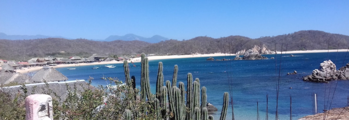
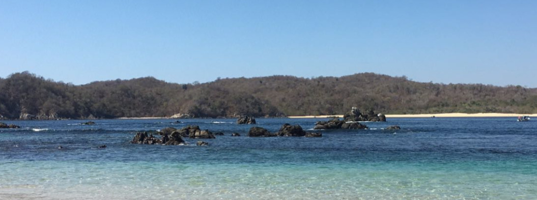
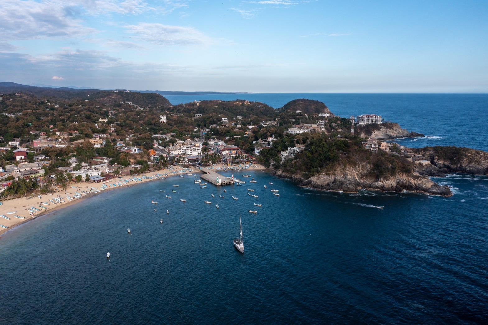
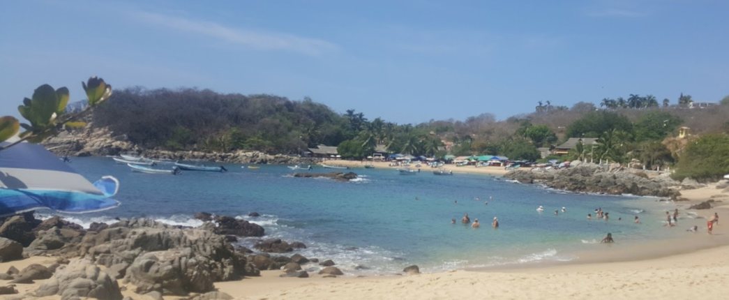
Puerto Angel lies at the southernmost point of the Oaxaca coastline 24NM west of Huatulco. The small lobate bay was established as a port for coffee export and is home to a large fleet of fishing pangas. The rocky headlands guard the bay from almost all swell except from the southern sector. Anchorage can be taken on either side of the bay depending upon the sea state.

Between October and February trade winds in the Gulf of Mexico blow across low points in the Isthmus funneling wind into the Golfo de Tehuantepec like a jet flame. These strong northerly winds last for 4-5 days and crossing the Gulf is not recommended during these events. The bays along the Huatulco coast have good shelter from the north and are ideal for cruisers to wait for good weather.

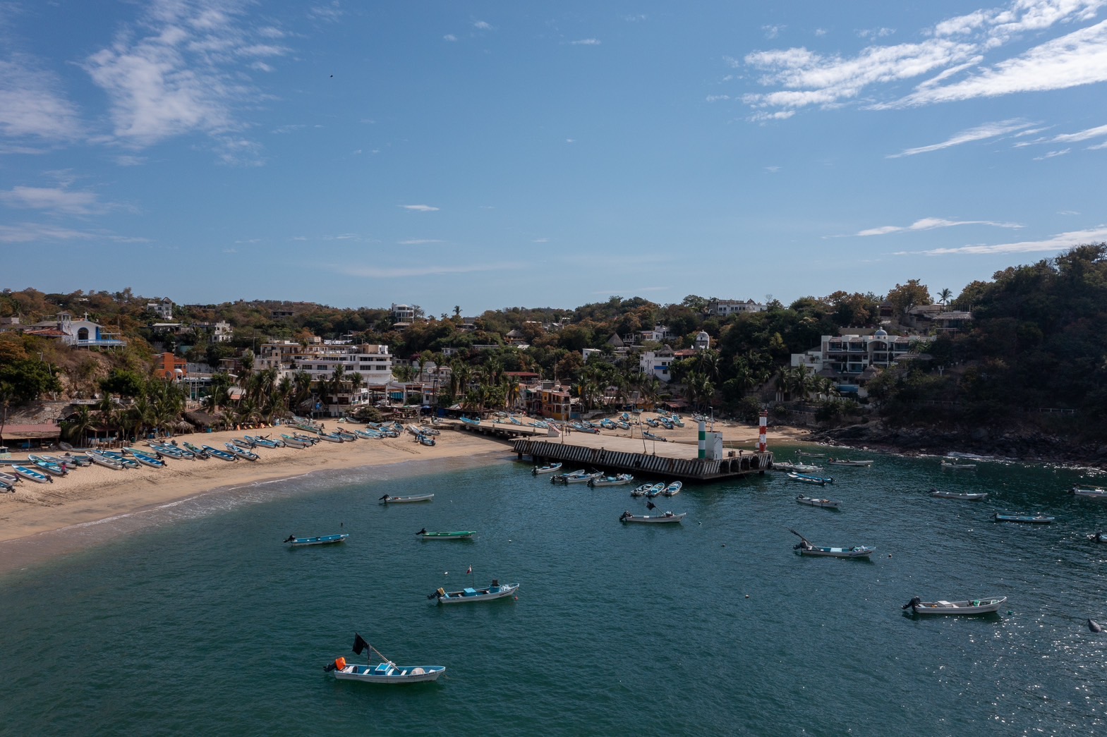
The beach at Puerto Angel is lined with more pangas than beach umbrellas reflecting the importance of fishing rather than tourism to the town’s economy. Even so the Port Captain welcomes cruisers to the picturesque village and the sheltered anchorage and invites you to slow down the pace and immerse yourself in Mexican village life.

Approaches

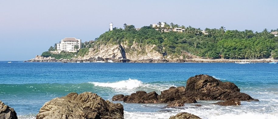
Approaching Puerto Angel stay well clear of rocks and reefs scattered along the rugged coast. Enter mid-channel and watch out for fishing boats and pleasure craft leaving the bay.

Anchorage

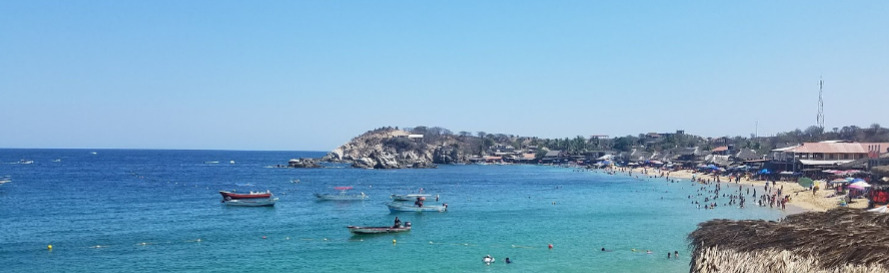
Anchor on the eastern side of the bay for shelter if the swell is from the southeast and easy access to the town. Drop the pick in 9m on sand with very good holding. Tie up at the end of the commercial dock or dinghy in to the beach east of the dock for an easier landing.

Facilities

The town has several laundries and grocery stores, plenty of restaurants and a great market. In the mornings fishing boats pull up on Playa Principal to sell their catch of red snapper, bonito, lobster, conch and octopus. The office of the Port Captain is located close to the commercial dock. Whale and dolphin watching tours can be booked in the village.

Dangers
Pangas
Wind Exposure
SE S SW
Swell Exposure
S SW
Amenities
Bank
Grocery Store
Fish Market
Market
Restaurants
Hotel
Date & Time Visited
2014-06-22T07:21:00
WILDFLOWER
Anchorage
Mexico - Pacific
Bahia Principal
Puerto Escondido
Depth
21.0 ft
6.3 m
Bottom Composition
S - Sand
Aids to Navigation
Lighthouse
Shore Access
Beach
Notes

Puerto Escondido is a major surfing destination and a marginal anchorage during the summer months except in calm conditions. Pounding swell creates perfect pipes and surfers from all over the world arrive here to compete in surf tournaments or just to ride a dream wave. The anchorage at the northern end of the bay is protected from the north and east but exposed to wind and swell from south and west.

In the early twentieth century the small fishing village in the northern corner of Bahia Escondido was established as a port for shipping coffee. Construction of highway 200 in the 1960’s brought potable water, surfers and eventually mass tourism to the area. Nonetheless the houses clustered around Playa Principal still retain some of their small town charm.

Approaches

The approach to Bahia Escondido is straight forward.

Anchorage

The sheltered part of the bay is full of moorings and local boats with rarely any space to anchor. Watch out for rocks off Mirador Romance on the east side of the cove and find a spot behind the mooring field in 6-8m on a sandy bottom. A stern anchor is recommended for a slightly more comfortable night. Land the dinghy at the west end of the beach behind the breakwater but be prepared for a surf landing.

Facilities

The town of Puerto Escondido has amenities to suit most cruisers needs. Restaurants and hotels fill the space between Playa Principal and the highway and on the north side you will find the centre of town with bakeries, grocery stores and supermarkets for provisioning, hardware stores, banks and hospitals, and a service station on the highway for filling jerry cans.

The town stretches down behind Playa Zicatela to the southern end of the beach and the road is lined with surf shops selling gear, lessons and board rental.

Dangers
Swell
Sandbar
Rocks and Boulders
Wind Exposure
SE S SW W
Swell Exposure
SE S SW W NW
Amenities
Bank
Bakery
Laundry
Supermarket
Hospital
Fuel via Jerrycans
Restaurants
Hotels
Surfschool
Airport
Date & Time Visited
2015-10-19T13:42:00
2018-01-18T11:11:11
editor