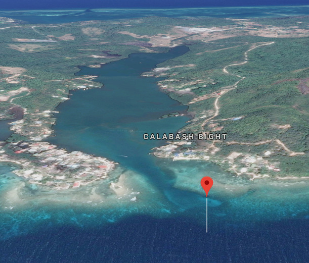
Anchorage
Honduras
Approach
◬ 16° 23.4134 N 86° 20.0792 W
Depth
16.0 ft
4.8 m
Bottom Composition
S - Sand
M - Mud
Aids to Navigation
Depth Contours
Land
Shore Access
Beach
Dock
Dangers
Narrow Path
Reef
Wind Exposure
S
Swell Exposure
S
dietmar
Anchorage
Honduras
Approach
◬ 16° 23.7389 N 86° 18.6814 W
Depth
15.0 ft
4.5 m
Bottom Composition
S - Sand
Aids to Navigation
Depth Contours
Land
Shore Access
Beach
Dock
Dangers
Extensive Reef System
Wind Exposure
E SE S
dietmar
Anchorage
Honduras
Approach
◬ 16° 24.0364 N 86° 17.4061 W
Depth
15.0 ft
4.5 m
Bottom Composition
S - Sand
M - Mud
Aids to Navigation
Depth Contours
Land
Shore Access
Beach
Dock
Wind Exposure
SW W
Swell Exposure
W
dietmar
Anchorage
Honduras
Approach
◬ 16° 24.4238 N 86° 13.8434 W
Depth
15.0 ft
4.2 m
Bottom Composition
S - Sand
M - Mud
Aids to Navigation
Depth Contours
Land
Shore Access
Beach
River
Wind Exposure
S SW
Swell Exposure
S SW
dietmar