Anchorage
Mexico - Pacific
Approach
◬ 16° 8.7358 N 95° 11.6555 W
◬ 16° 9.6559 N 95° 11.4650 W
◬ 16° 9.9774 N 95° 11.4611 W
Depth
30.0 ft
Bottom Composition
S - Sand
Aids to Navigation
Depth Contours
Land
Shore Access
Beach
Dock
Notes

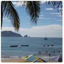
Anchorage can be taken on the eastern side of the harbour wall of Puerto Salina Cruz with permission from the Port Captain. This is a roadstead anchorage but is sheltered from westerly swell by the peninsula/breakwater and the hills behind the town provide some protection from northerly wind. It is not recommended during southerly conditions.

Between October and February trade winds in the Gulf of Mexico blow across low points in the Isthmus funneling wind into the Golfo de Tehuantepec like a jet flame. These strong northerly winds last for 4-5 days and crossing the Gulf is not recommended during these events. Salina Cruz is a good spot for cruisers to wait for good weather.

The small town of Salina Cruz is convenient for clearing in or out of Mexico as the offices of all the necessary authorities lie within a few of blocks of each other.

Approaches

Approach to the anchorage at Puerto Salina Cruz is straight forward.

Anchorage

Anchor in front of the town in 9m on sand. Land the dinghy on the beach if the waves permit otherwise ask the Port Captain for permission to enter the outer harbour and tie up with the pangas.

Facilities

With supermarkets, laundries, hardware stores and banks Salina Cruz has plenty of scope for fulfilling cruisers needs.   The only tourists the town attracts are surfers who come to ride the flawless point breaks of the area but there are a few hotels and restaurants in town and surf camps on the beach. Fuel can be obtained by jerry can from the service station across the street from the Port Captains office.

Dangers
Commercial Port
shipping traffic
Swell
Wind Exposure
E SE S SW W
Swell Exposure
E SE S SW
Amenities
Supermarket
Bank
Laundry
Restaurants
Hospital
Fuel via Jerrycans
Airport
SV DISTANT DRUMMER
Anchorage
Mexico - Pacific
Rocky Melaque
Approach
◬ 19° 12.7642 N 104° 42.5335 W
◬ 19° 12.9539 N 104° 42.5309 W
◬ 19° 13.2408 N 104° 42.7472 W
Depth
30.0 ft
9.0 m
Bottom Composition
S - Sand
Aids to Navigation
Depth Contours
Land
Shore Access
Beach
Notes

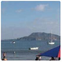
Playa Melaque is another beautiful white sand beach nestled in the craggy cliffs of the Jalisco coastline. The town lies at the northern end of Bahia Navidad, a long bay which open the the south and west. Laguna de Barra de Navidad is located on the southeastern side. The reefs and islets of Punta Melaque protect Melaque from swell from the west and northwest but should be given a wide berth when entering the anchorage.

Approaches

Straight forward approach.

Anchorage

Tuck in east of Punta Melaque and anchor behind the panga fleet in 5m on muddy sand. Watch out for fish pens which are common in this bay. Take the dingy in to the northwest corner of the beach however it can be boisterous if a southerly swell is running.

Facilities

Generations of Mexicans have been visiting the beach at Melaque long before the snowbirds arrived. It is a traditional town with a  picturesque square, several laundries, supermarkets and banks and plenty of good restaurants. The town also has a couple of hospitals and a service station 2.2km from the beach on the main highway. Snorkeling around Isla Toriz is good.

Dangers
Swell
Wind Exposure
E SE S SW
Swell Exposure
SE S SW
Amenities
Restaurant
Bars
Supermarket
Laundry
Bank
Hospital
Internet
Seaglub