Anchorage
Mexico - Pacific
Approach
◬ 24° 17.8651 N 110° 20.4307 W
Depth
14.0 ft
4.2 m
Bottom Composition
S - Sand
Aids to Navigation
Depth Contours
Land
Shore Access
Beach
Notes

La Paz Channel – N anchorage lies in a small indentation on the south side of Caleta Lobos. It is exposed to westerly wind and swell and is not a good anchorage if a westerly buster is forecast.

Approaches

No info

Anchorages

Anchor in the southern corner of the bay in 4m on a sandy bottom. Easy access to the beach except in a westerly swell. when it becomes a lee shore

Facilities

None.

Dangers
Squalls
Wind Exposure
SW W NW
Swell Exposure
W
marina
Anchorage
Mexico - Pacific
San Rafaelito
El Merito Cove
Approach
◬ 24° 17.8438 N 110° 20.4596 W
Depth
16.0 ft
4.8 m
Bottom Composition
S - Sand
Aids to Navigation
Depth Contours
Land
Shore Access
Beach
Notes

La Paz North anchorage lies behind the island on the northern side of Caleta Lobos, 1.5NM south of Bahia Balandra. Caleta Lobos is a fairly large anchorage with space for more than 20 boats and it is calm in all but a westerly wind.

Be cautious while swimming or snorkeling as venomous sea snakes are reported to breed in this cove.

Approaches

No info

Anchorage

Anchor in the northern Bay in 5 m in sand. Dinghy access to either one of the gorgeous white sand beaches in the bay.

Facilities

None. The bay has no road access so is much quieter than B. Balandra.

Dangers
Squalls
Wind Exposure
S SW
marina
Anchorage
Mexico - Pacific
El Portico
Approach
◬ 24° 32.3627 N 110° 21.2167 W
Depth
15.0 ft
4.5 m
Bottom Composition
S - Sand
Aids to Navigation
Depth Contours
Land
Shore Access
Beach
Estuary
Notes

Ensenada de la Partida lies at the east end of the channel between Isla Espiritu Santo from Isla Partida. The bay is open to the north through to the southeast but it is a good spot to shelter during a westerly buster with protection from the swell.

Approaches

No info

Anchorage

This is a deep bay and it is a good idea to tuck in as close to the sand spit as possible to gain some shelter from the north. Anchor in 4.5m on sand with good holding. The bay is reported to have moderate protect from the N-NW. Dinghy ashore to the sand spit.

Facilities

None.

Dangers
Bay Shallows
Wind Exposure
NE E SE
Swell Exposure
NE E SE
marina
Anchorage
Mexico - Pacific
Approach
◬ 24° 24.8034 N 110° 23.4890 W
◬ 24° 24.8292 N 110° 21.9131 W
◬ 24° 24.7237 N 110° 21.4316 W
◬ 24° 24.6792 N 110° 21.1226 W
◬ 24° 24.5924 N 110° 21.0093 W
Depth
10.0 ft
3.0 m
Bottom Composition
S - Sand
Aids to Navigation
Depth Contours
Land
Shore Access
Beach
Notes

From the southern tip of Isla Espiritu Santo this tiny cove is the first of ten bays located between the finger-like peninsulas of the west coast of the island. Between the rocky red walls at Ensenada Dispensa a strand of golden sand lines the head of the bay. Seasonal fishing camps can often be found in this bay.

Approaches

No info

Anchorage

The bay is shallow but anchorage can be taken in 2-3m on a sandy bottom. The cove is sheltered from all but a coromuel when it becomes a lee shore with very little space to drag anchor.

Facilities

None.

Dangers
Bay Shallows
Squalls
Wind Exposure
SW W NW
Swell Exposure
SW W NW
marina
Anchorage
Mexico - Pacific
Named Ensenada de la Gallina in Navionics
Approach
◬ 24° 27.4993 N 110° 26.2081 W
◬ 24° 27.6540 N 110° 23.4993 W
◬ 24° 27.6634 N 110° 22.7165 W
◬ 24° 27.6119 N 110° 22.3509 W
◬ 24° 27.8275 N 110° 22.1500 W
Depth
11.0 ft
3.3 m
Bottom Composition
S - Sand
Aids to Navigation
Depth Contours
Land
Shore Access
Beach
Notes

Another beautiful but shallow bay on the west coast of Isla Espiritu Santo. Hiking and scrambling up the gulley at the head of the bay reveals a fabulous view from the top of the ridge. This anchorage is not recommended if a westerly wind is likely.

Approaches

No info

Anchorage

The bay is shallow but anchorage can be found in 3.6m on sand at the mouth of the bay. It is sheltered from all but a westerly buster although some swell might wrap around the headland on the northern side.

Facilities

None.

Dangers
Bay Shallows
Squalls
Wind Exposure
SW W NW
Swell Exposure
SW W NW
Amenities
SUP
marina
Anchorage
Mexico - Pacific
Named Ensenada del Gallo in Navionics
Approach
◬ 24° 28.4485 N 110° 22.7397 W
◬ 24° 28.2493 N 110° 23.0744 W
◬ 24° 28.1743 N 110° 23.4221 W
◬ 24° 28.1087 N 110° 24.6065 W
◬ 24° 28.0478 N 110° 24.8589 W
Depth
11.0 ft
3.3 m
Bottom Composition
S - Sand
Aids to Navigation
Depth Contours
Land
Shore Access
Beach
Notes

This is the first bay to the south of Isla Ballena on the west coast of Isla Espiritu Santo and is the best anchorage of the three inlets in Bahia Ballena. A peaceful spot however swarms of water collector bees can be irritating but not aggressive.

Approaches

No info

Anchorage

Anchor in the lee of Punta Ballena in 3-4m for good protection for the prevailing northerly wind and swell. The anchorage is not recommended in a westerly buster.

Facilities

None.

Dangers
Bay Shallows
Squalls
Wind Exposure
SW W NW
Swell Exposure
SW W NW
Amenities
SUP
marina
Anchorage
Mexico - Pacific
Approach
◬ 24° 28.1134 N 110° 25.2348 W
◬ 24° 28.3103 N 110° 23.9679 W
◬ 24° 28.7509 N 110° 23.7516 W
◬ 24° 28.9243 N 110° 23.9422 W
Depth
24.0 ft
7.3 m
Bottom Composition
S - Sand
Aids to Navigation
Depth Contours
Land
Shore Access
Beach
Notes

This  roadstead anchorage located in the lee of Isla Ballena offers some shelter from weather from the north.  The underwater caverns on the north and west side of the island are good for diving or snorkeling.

Approaches

No info

Anchorage

Anchor in 7.3m in sand.

Facilities

None.

Dangers
Swell
Wind Exposure
NE E SE S SW
Swell Exposure
E SE S SW
marina
Anchorage
Mexico - Pacific
Approach
◬ 24° 34.0031 N 110° 24.4353 W
◬ 24° 33.5359 N 110° 24.7790 W
◬ 24° 33.5230 N 110° 25.6957 W
Depth
15.0 ft
4.5 m
Bottom Composition
S - Sand
Aids to Navigation
Depth Contours
Land
Shore Access
Beach
Notes

This anchorage is located in Ensenada Grande just south of Punta Tintorera at the NW corner of Isla Partida. The point provides great protection from wind and swell from the north but the bay is open to the west and south.

Approaches

No info

Anchorage

Tuck in to the northeast corner of Ensenada Grande in 5m on a sandy bottom. Dinghy in to the beach at the head of the narrow inlet.

Facilities

None.

Dangers
Squalls
Wind Exposure
S SW W
Swell Exposure
S SW W
marina
Anchorage
Mexico - Pacific
Ensenada Grande South
Approach
◬ 24° 33.4223 N 110° 26.2030 W
◬ 24° 33.5769 N 110° 24.6297 W
◬ 24° 33.5488 N 110° 24.0709 W
◬ 24° 33.6331 N 110° 23.7542 W
Depth
22.0 ft
6.7 m
Bottom Composition
S - Sand
Aids to Navigation
Depth Contours
Land
Shore Access
Beach
Notes

South of Punta Tintorera, Ensenada Grande is a large bay with three inlets spearing into the west coast of Isla Partida. The anchorage located in the southern inlet. The bay is well protected from the south by Punta Tijeretas but is open to west and not recommended if a westerly buster is likely.

This is a popular anchorage and diving/camping tours run by Fun Baja operate from here so you may not be alone.

Approaches

No info

Anchorage

The channel into Ensenada Grande Sur is 10m deep in the centre and the sides shallow up to the foot of the cliffs which bound the inlet. Anchor anywhere in the cove in 5-10m on a sandy bottom. The anchorage may be rolly in a northerly swell.

Facilities

None.

Dangers
Squalls
Wind Exposure
SW W NW
Swell Exposure
W NW
Amenities
Hiking
Diving
marina
Anchorage
Mexico - Pacific
Depth
33.0 ft
10.0 m
Bottom Composition
S - Sand
Aids to Navigation
Depth Contours
Land
Shore Access
Beach
Notes

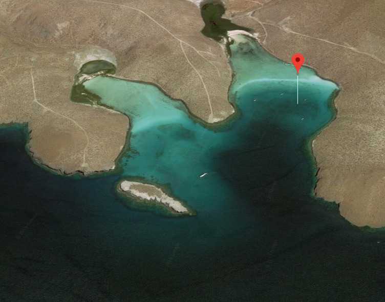
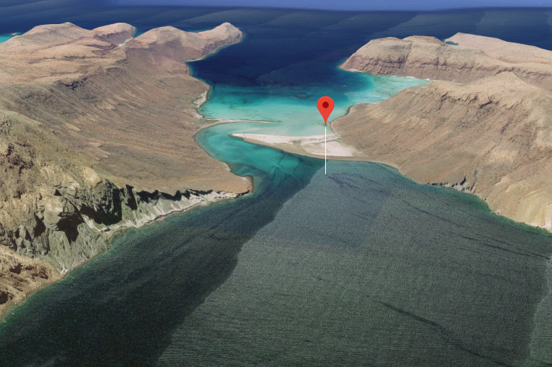
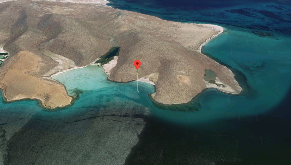
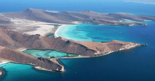
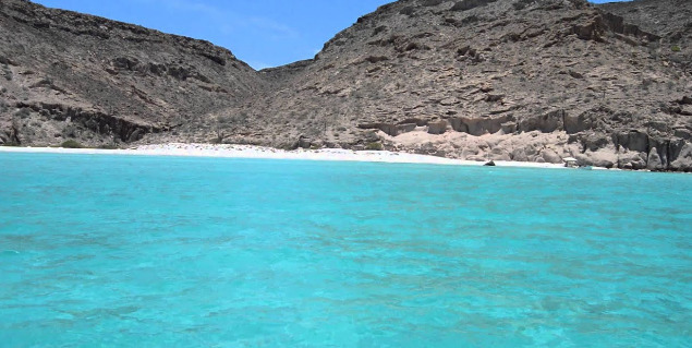
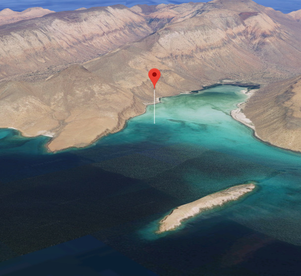
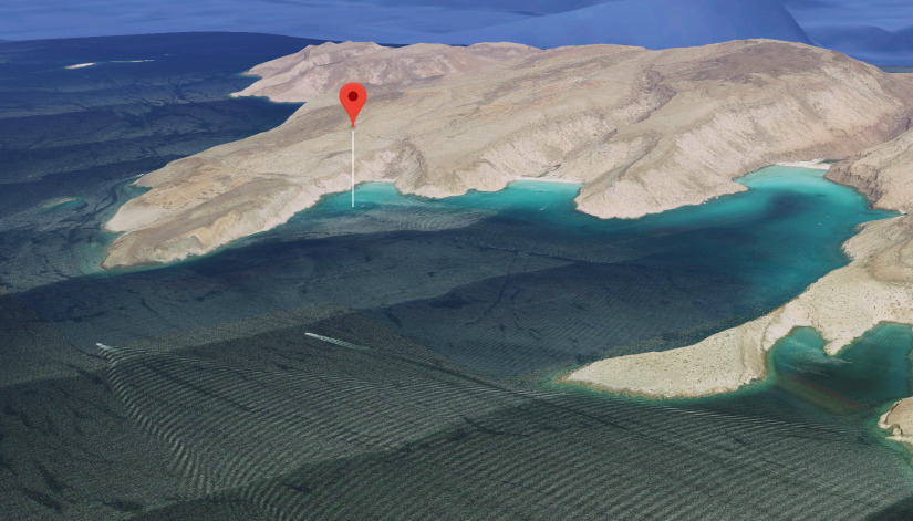
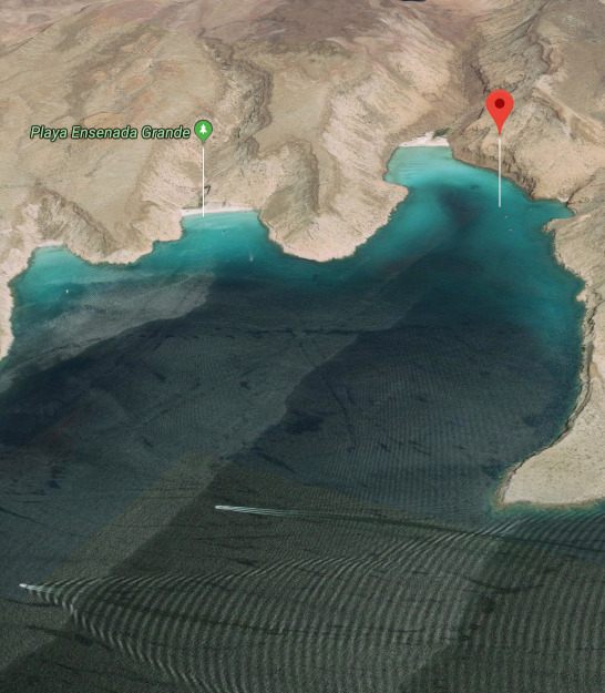
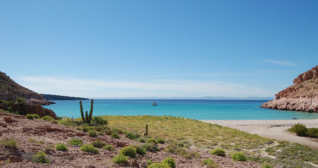
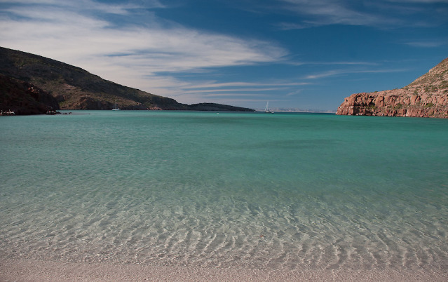
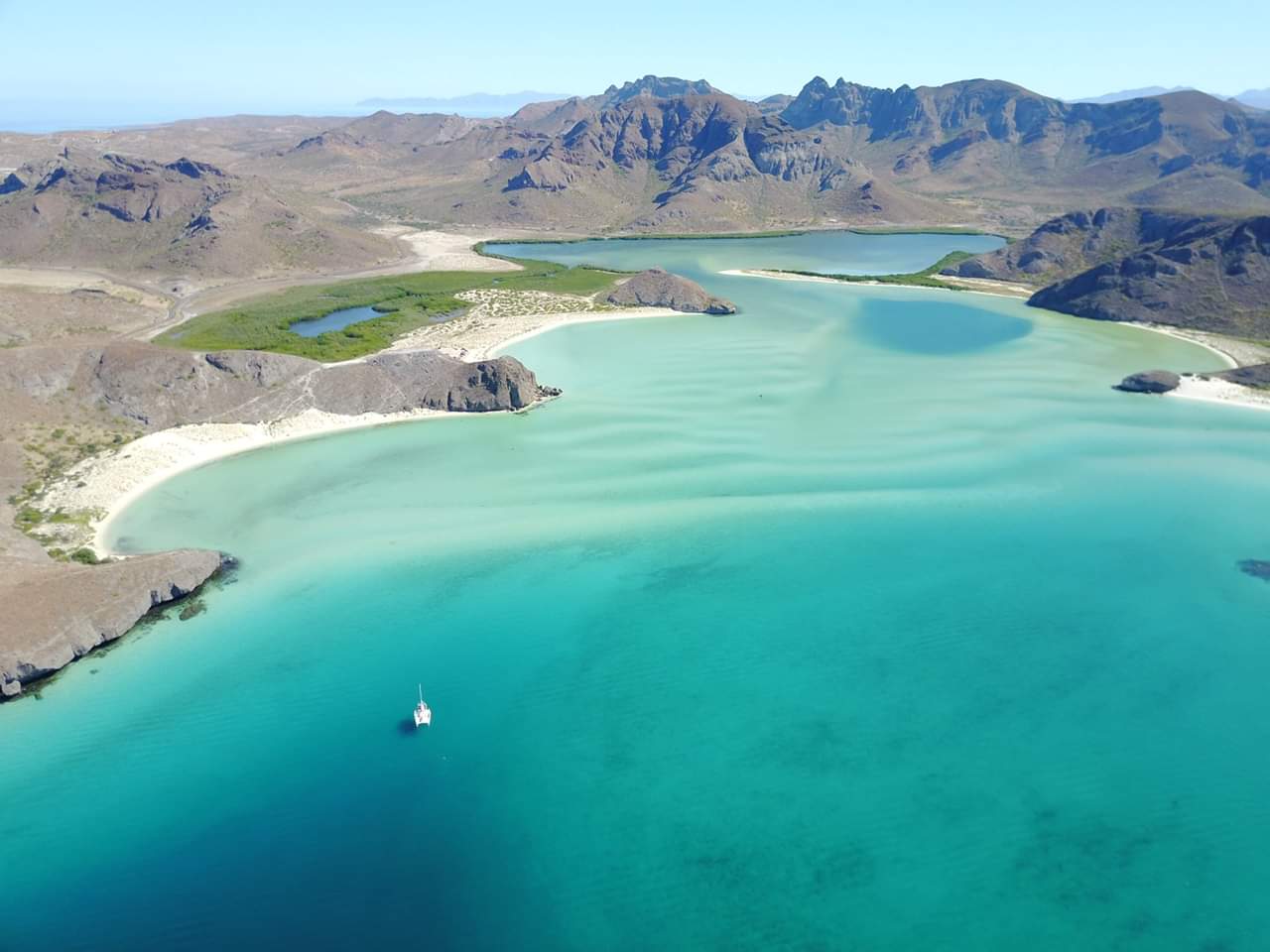
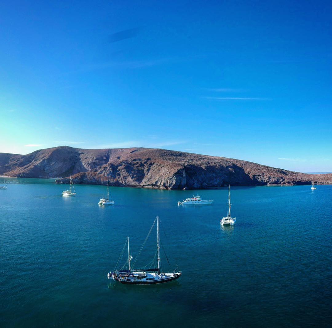
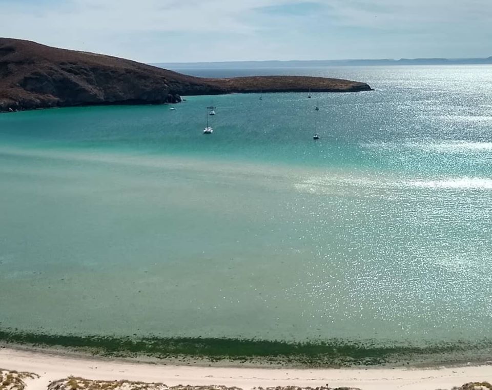
Bahia Balandra lies 4NM SSW of Canal de San Lorenzo, the channel which separates Isla del Espíritu Santo and the Peninsula San Rosario east of La Paz. The bay has several beautiful white sand beaches and an interesting hongo/mushroom "sculpture" stands on the north side of the bay.The bay gets crowded with local boats at weekends.

While in the Bahia La Paz area watch out for the strong squally winds locally called coromuels which blow up at night. West facing bays north of La Paz and on the Isla del Espiritu Santo and the northern isles can become a dangerous lee shores.

Approaches

No info

Anchorage

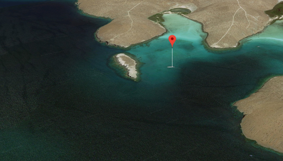
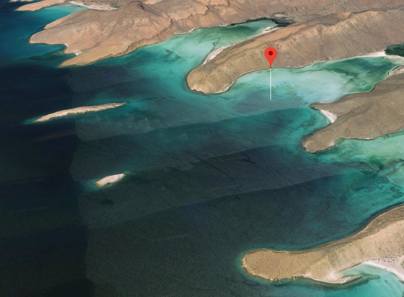
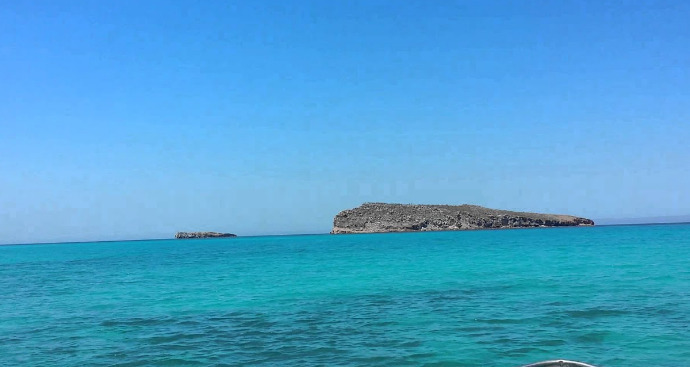
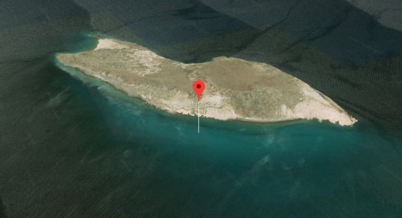
The bay is shoal east of the small islet on the north side of Punta del Diablo but anchorage can be taken west of the islet in 10m on a sandy bottom with good holding. The bay is open to the west but even in a northerly breeze the swell wraps Punta Balandra making for a rolly night. Shore access to the beach by dinghy can be challenging when the swell is rolling into the bay.

Facilities

None except the bay has cellular reception. 

Dangers
Crowded on Weekends
Squalls
Wind Exposure
NW
Date & Time Visited
2018-11-29T11:11:11
2020-04-24T11:11:11
Liquid