Anchorage
Mexico - Pacific
Approach
◬ 16° 8.7358 N 95° 11.6555 W
◬ 16° 9.6559 N 95° 11.4650 W
◬ 16° 9.9774 N 95° 11.4611 W
Depth
30.0 ft
Bottom Composition
S - Sand
Aids to Navigation
Depth Contours
Land
Shore Access
Beach
Dock
Notes

Anchorage can be taken on the eastern side of the harbour wall of Puerto Salina Cruz with permission from the Port Captain. This is a roadstead anchorage but is sheltered from westerly swell by the peninsula/breakwater and the hills behind the town provide some protection from northerly wind. It is not recommended during southerly conditions.

Between October and February trade winds in the Gulf of Mexico blow across low points in the Isthmus funneling wind into the Golfo de Tehuantepec like a jet flame. These strong northerly winds last for 4-5 days and crossing the Gulf is not recommended during these events. Salina Cruz is a good spot for cruisers to wait for good weather.

The small town of Salina Cruz is convenient for clearing in or out of Mexico as the offices of all the necessary authorities lie within a few of blocks of each other.

Approaches

Approach to the anchorage at Puerto Salina Cruz is straight forward.

Anchorage

Anchor in front of the town in 9m on sand. Land the dinghy on the beach if the waves permit otherwise ask the Port Captain for permission to enter the outer harbour and tie up with the pangas.

Facilities

With supermarkets, laundries, hardware stores and banks Salina Cruz has plenty of scope for fulfilling cruisers needs.   The only tourists the town attracts are surfers who come to ride the flawless point breaks of the area but there are a few hotels and restaurants in town and surf camps on the beach. Fuel can be obtained by jerry can from the service station across the street from the Port Captains office.

Dangers
Commercial Port
shipping traffic
Swell
Wind Exposure
E SE S SW W
Swell Exposure
E SE S SW
Amenities
Supermarket
Bank
Laundry
Restaurants
Hospital
Fuel via Jerrycans
Airport
SV DISTANT DRUMMER
Anchorage
Mexico - Pacific
Santa Cruz West
Depth
30.0 ft
Bottom Composition
S - Sand
Aids to Navigation
Depth Contours
Land
Shore Access
Beach
Notes

Playa la Entrega is party central in Bahia Santa Cruz so not a good spot if peace and quiet is what you had in mind. The cove on the western side of Bahia Santa Cruz is very sheltered, it is open to the northeast but a southerly or southeasterly swell can sometimes wrap around the point.

Moorings, tour boats and pangas fill up the eastern side of the bay but anchorage is possible in the deeper water areas. The water is busy with jet skis, parasail jockeys and even swimmers coming to check out the boat. It is loud and fun but can be a bit rolly with the wakes.

In June 2020 the area was hit by a 7.4 earthquake and the seafloor around Huatulco was deformed and uplifted more than 0.5m in places. The charts for the area are no longer reliable and should be used with caution.

Approaches

Entrance to Playa la Entrega is straight forward.

Anchorage

Anchor in 5-10m on sand. Beach access by dinghy is restricted to the buoyed channel at the eastern end of the beach. This is really intended for tour boats and parasail boats to pick up passengers. If the beach is busy swim, kayak or SUP ashore instead.

Facilities

About a dozen restaurants line the beach at Playa la Entrega but not much else is available. For provisioning it is an 8km taxi ride to La Crucecita.

Dangers
Swimming Zone
Tour Boats
Rocks and Boulders
Inaccurate Charts
Wind Exposure
NE E
Swell Exposure
NE E SE
Amenities
Restaurants
Hospital
Airport
SV DISTANT DRUMMER
Anchorage
Mexico - Pacific
Depth
25.0 ft
7.3 m
Bottom Composition
S - Sand
M - Mud
Aids to Navigation
Depth Contours
Land
Lights
Shore Access
Dock
Notes

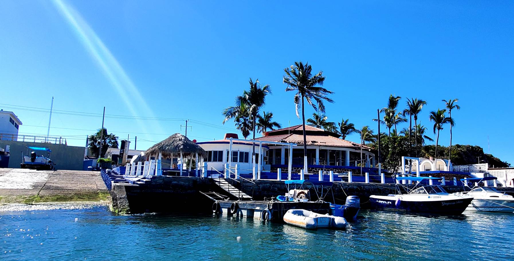
Club Nautico in Mazatlan’s inner harbour is legendary in Mexican Cruising circles. Located close to the old city the Club has served as a  focal point for anchorage, yacht services and good times with other yachties for decades. Sadly now the building is dilapidated (although the shower still worked in 2017!) but the staff still manage the boat ramp, dinghy dock and are very helpful and friendly to visiting yachts. Contact the Club’s harbour master on VHF16 for permission to anchor and use the dinghy dock for which a small fee is charged. Laundry, garbage and potable water services are available.

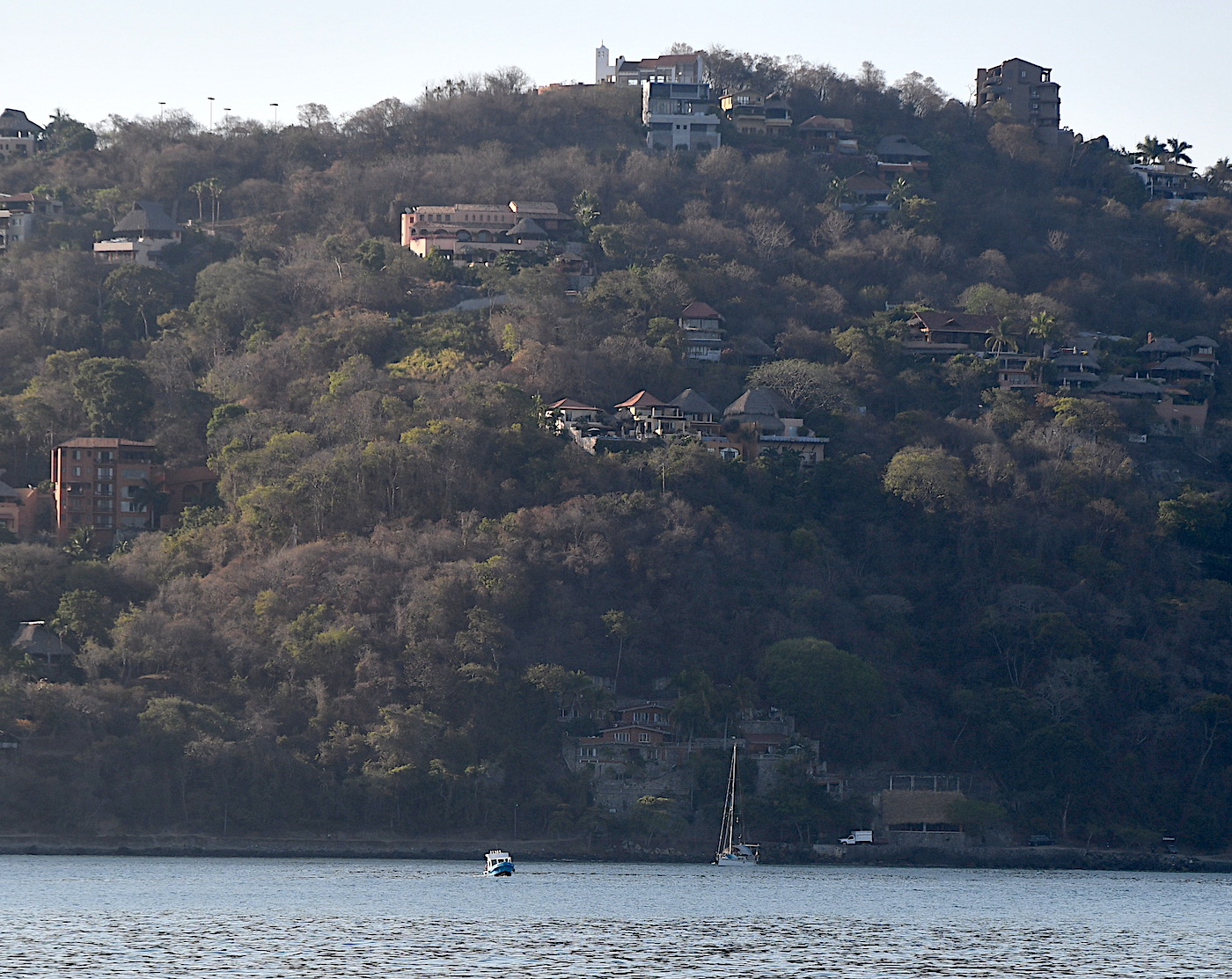
Old Mazatlan is very picturesque and the historic buildings, steep hills and narrow streets have a distinctly European feel. The city was founded by the Spanish in 1531 but remained just a quiet fishing village until the mid-nineteenth century when it was developed as a seaport to import equipment for the nearby gold and silver mines. A group of German settlers established the Pacifico brewery in Mazatlan and have been brewing great beer ever since.

The inner harbour is well sheltered except for a strong easterly which blows over the breakwater. When the wind blows from the west the smell from the nearby wastewater treatment plant can be quite overpowering.

Approaches

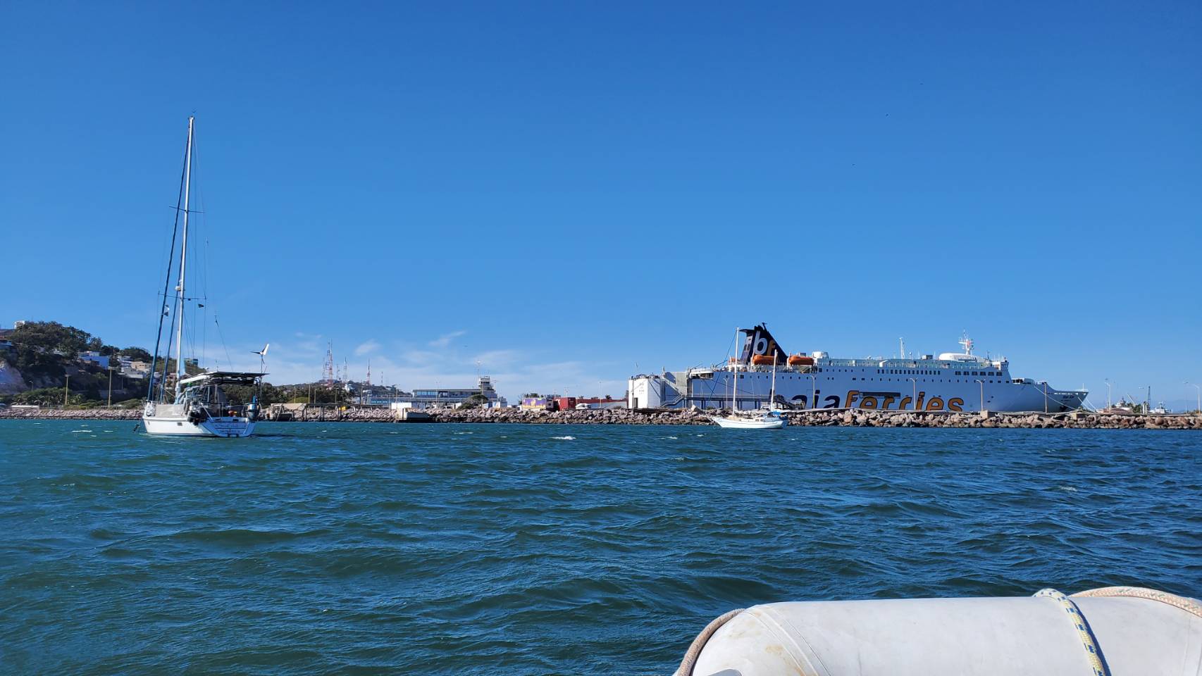
Mazatlan is a very busy port with container ships and cruise ships, ferries and fishing boats entering and leaving at all hours. Before entering the inner harbour call “Transito Maritimo” or “Mazatlan Harbour Traffic” on VHF16 to be allocated a time for entry between the other vessels.
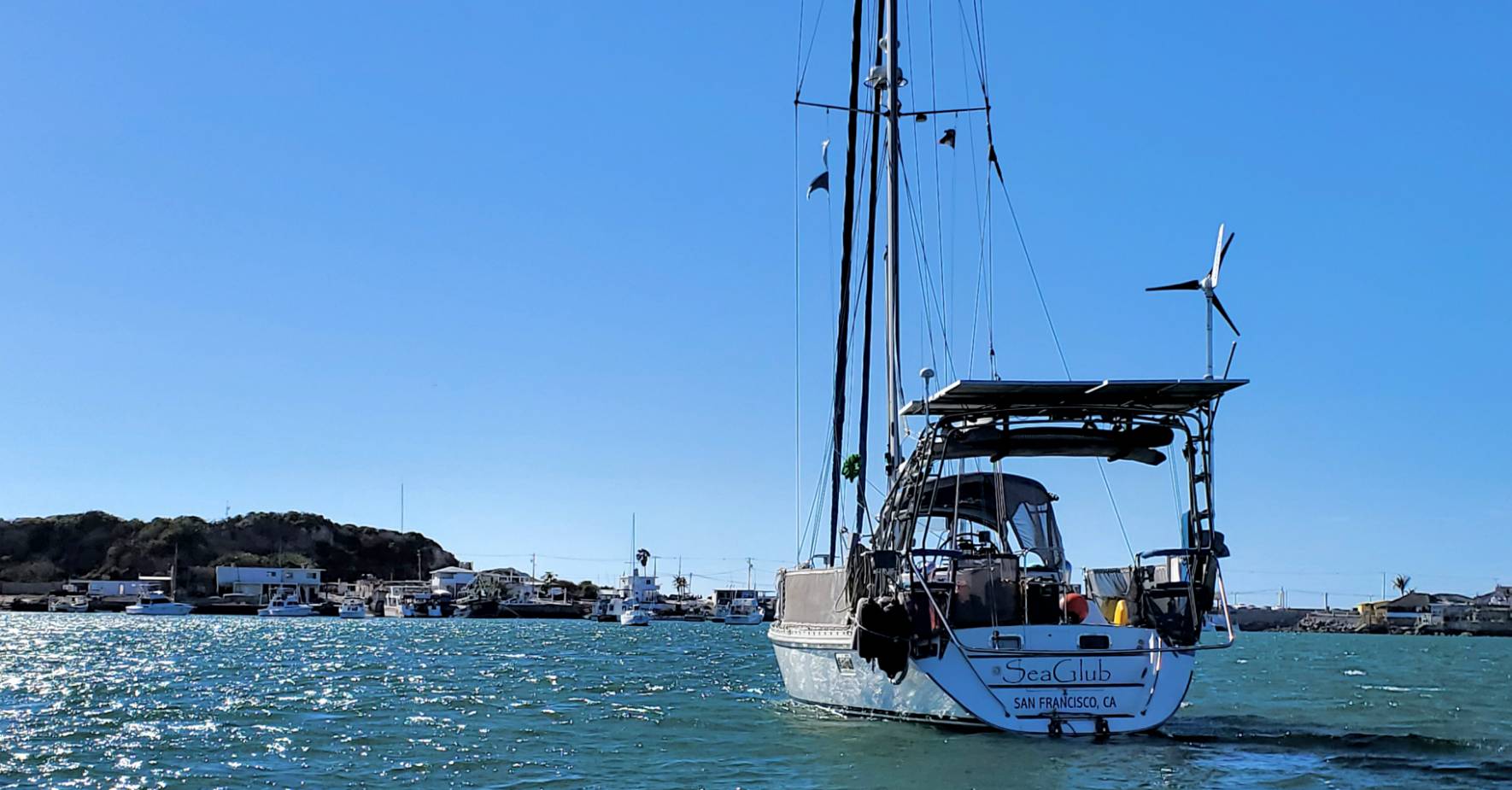
Anchorage

Anchor in 7m off the Club Nautico dinghy dock in sand and mud. Make sure the anchor is well set as boats have been know to drag. Tie the dinghy up at the Clubs dinghy dock for a small fee. Make sure it is well locked and ask Martin to keep an eye on it.

Facilities

Mazatlan is a fascinating city full of old world charm, new world bustle and Latin spirit. Exploring the back streets of the old town by foot or bike is endlessly fascinating; cobbled streets, old buildings and great views around every turn. Visit the basilica and the market and later in the afternoon stroll along the Malecon to La Clavadista. For 300 pesos macho men dive off the 100’ crag into a tiny tidal pool where the surf crashes the rocks.

For provisioning the city has numerous supermarkets and grocery stores and stores of every other hue to suit most cruisers needs. The market which lies a couple of blocks north of the Basilica is great for fresh produce. The city is well served with banks, restaurants and hotels for every budget and medical facilities for every ailment.

Dangers
Anchoring Restrictions
Wind Exposure
NE E SE
Amenities
Dinghydock
City
Provisioning
Restaurants
Supermarket
Grocery Store
Potable Water
Garbage Disposal
Bank
Hospital
Airport
Date & Time Visited
2020-03-23T23:11:11
Seaglub
Anchorage
Mexico - Pacific
La Ropa Anchorage
Approach
◬ 17° 37.0978 N 101° 34.3196 W
◬ 17° 37.5248 N 101° 33.2742 W
◬ 17° 37.5199 N 101° 32.8725 W
Depth
20.0 ft
6.1 m
Bottom Composition
S - Sand
Aids to Navigation
Depth Contours
Land
Shore Access
Beach
Dock
Notes

Playa la Ropa is open to the west and is exposed to wind and swell from that sector and the interaction of the two can make the anchorage rolly and uncomfortable. On the plus side the anchorage is less busy than at Playa Madera, the water is cleaner and the beautiful beach of Playa La Ropa is on the doorstep.

Approaches

The approach is straight forward. Look out of Roca Negra1.5NM southwest of Punta Garrobo if arriving from the south.

Anchorage

Anchor anywhere off the beach in 6m on sand with good holding. Landing the dinghy ashore can be hazardous when the swell is running. Alternatively tie up at the commercial pier east of Playa Las Gatas, a dinghy anchor is recommended to keep you off the dock.

Facilities

The development on the east side of Bahia Zihuatanejo is almost all beach front restaurants and hotels with an occasional small grocery store for basics. A 3.2km bus or taxi ride will take you into the centre of town for great provisioning a megastores, supermarkets of the fabulous Mercado Central.

Playa Las Gatas is quieter and has several palapa restaurants to enjoy. “El Rey de Reyes” which lies just off the beach is an incredible snorkeling spot where a 4m high underwater statue of Jesus stands on the coral reef.

Dangers
Swell
Use Stern Anchor
Wind Exposure
N SW W NW
Swell Exposure
SW W NW
Amenities
Restaurant
Airport
Hospital
Fuel via Jerrycans
Date & Time Visited
2019-04-12T11:11:11
Seaglub
Anchorage
Mexico - Pacific
Rocky Melaque
Approach
◬ 19° 12.7642 N 104° 42.5335 W
◬ 19° 12.9539 N 104° 42.5309 W
◬ 19° 13.2408 N 104° 42.7472 W
Depth
30.0 ft
9.0 m
Bottom Composition
S - Sand
Aids to Navigation
Depth Contours
Land
Shore Access
Beach
Notes

Playa Melaque is another beautiful white sand beach nestled in the craggy cliffs of the Jalisco coastline. The town lies at the northern end of Bahia Navidad, a long bay which open the the south and west. Laguna de Barra de Navidad is located on the southeastern side. The reefs and islets of Punta Melaque protect Melaque from swell from the west and northwest but should be given a wide berth when entering the anchorage.

Approaches

Straight forward approach.

Anchorage

Tuck in east of Punta Melaque and anchor behind the panga fleet in 5m on muddy sand. Watch out for fish pens which are common in this bay. Take the dingy in to the northwest corner of the beach however it can be boisterous if a southerly swell is running.

Facilities

Generations of Mexicans have been visiting the beach at Melaque long before the snowbirds arrived. It is a traditional town with a  picturesque square, several laundries, supermarkets and banks and plenty of good restaurants. The town also has a couple of hospitals and a service station 2.2km from the beach on the main highway. Snorkeling around Isla Toriz is good.

Dangers
Swell
Wind Exposure
E SE S SW
Swell Exposure
SE S SW
Amenities
Restaurant
Bars
Supermarket
Laundry
Bank
Hospital
Internet
Seaglub
Anchorage
Mexico - Pacific
Playa Caletilla
Approach
◬ 16° 49.7957 N 99° 55.4118 W
◬ 16° 49.5616 N 99° 54.9843 W
◬ 16° 49.6109 N 99° 54.2183 W
◬ 16° 49.7476 N 99° 54.1835 W
Depth
34.0 ft
10.3 m
Bottom Composition
S - Sand
Aids to Navigation
Depth Contours
Land
Lighthouse
Shore Access
Beach
Watertaxi
Notes

Playa Caleta is located outside Bahia Acapulco on the south side of Peninsula Las Playas. The anchorage is usually full of local boats on moorings but you may get lucky and find a spot to tuck in where the water is not too deep. This small cove is sheltered from north and south but is open to the swell that wraps around Punta Lorenz from the northwest or around Isla la Roqueta from the southeast.

Approaches

Playa Caleta can be approached from east or west keeping mid-channel and avoiding the numerous pleasure boats crossing to Isla Roqueta.

Anchorage

Tuck in to the bay and 10-20m on sand. Land the dinghy ashore at one of the beaches on the north side of the bay.

Facilities

For provisioning a bank and a well stocked supermarket are located over the hill opposite La Marina de Acapulco. To enjoy great cocktails, wonderful sunsets and a little faded Hollywood glamour stroll or take a taxi to the Flamingo Hotel, a favorite hideaway of Cary Grant, John Wayne and Johnny Weissmuller.

Dangers
Tour Boats
Wind Exposure
SE S SW
Swell Exposure
E SE W NW
Amenities
Restaurant
Bars
Supermarket
Bank
Hospital
Airport
dietmar
Anchorage
Mexico - Pacific
Caleta Angeles Cove
Playa Puerto Angelito
Approach
◬ 15° 51.0989 N 97° 4.6224 W
◬ 15° 51.2884 N 97° 4.4074 W
◬ 15° 51.3800 N 97° 4.4049 W
Depth
14.0 ft
4.6 m
Bottom Composition
S - Sand
Aids to Navigation
Depth Contours
Land
Shore Access
Beach
Notes

Caleta Angeles is a small wooded cove on the northern side of Puerto Escondido. The bay is open to the south but is surrounded by steep hills and has good protection from weather from elsewhere. Swell from south and west diffracts into the bay making this a rolly anchorage. The western lobe of the bay is often filled with pangas and a rock in the centre of the bay further limits the available anchoring space. A stern anchor is strongly recommended.

Approaches

Entering this small cove stay mid-channel and watch the depth closely as the bay shallows quickly.

Anchorage

Anchor in 4.6m on sand in the centre of the bay keeping well clear of the rocky shoreline which often has breaking surf. Take the dinghy ashore to the beach on the west side of the bay which is more sheltered from the swell.

Facilities

There are several palapa restaurants around the beaches in the cove. For provisioning take a 1.5km taxi ride into Puerto Escondido which has banks, a large supermarket and plenty more restaurants.

Dangers
Swell
Pangas
Fishing Vessels
Rocks
Swimming Zone
Wind Exposure
SE S SW
Swell Exposure
SE S SW
Amenities
Town
Restaurants
Hospital
Airport
Anonymous